


LiDAR derived asset and built environment datasets will be generated by AAM over transmission lines and easements for a client this season. The object is to establish accurate spatial relationships between the ground, vegetation, conductors and earth wires along these transmission lines. Data gathered shall be used to produce accurate engineering design models of the transmission lines and its corridor for the assessment of transmission capacity.
This is one of many LiDAR projects underway in Australia utilising the powerful Optech LiDAR sensor.
The colourised point cloud of LIDAR strikes in the image shown, clearly highlights the vegetation in green and residential areas in shades of grey and white. The classified conductors have been classified in yellow and blue to enhance their appearance on this image.
The benefits of LIDAR data are being embraced by many energy clients requiring: speed; accuracy; minimal or no ground survey; and a variety of derived products for the natural and built environments.
More information is available on our LiDAR webpage
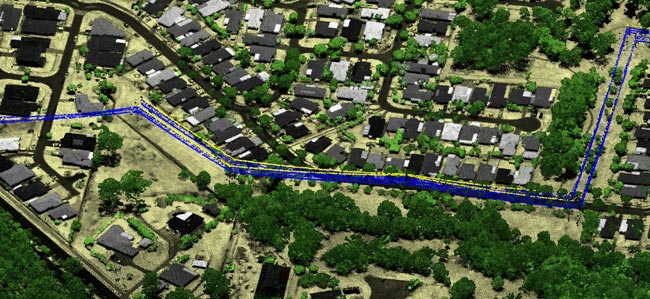
Above: Subset of LiDAR imagery from our current 800km corridor project
 (1)")
")

")
")
")