


How do heavily populated cities like Hong Kong plan for disaster relief, environmental impacts of development, and increased demand on infrastructure and energy supply?
AAM’s David Jonas and researchers at Hong Kong Polytechnic University tell China Daily how 3D Mapping techniques give planners and engineers the vital information they need to build Smart Cities.
Read the full article here, or download the PDF.
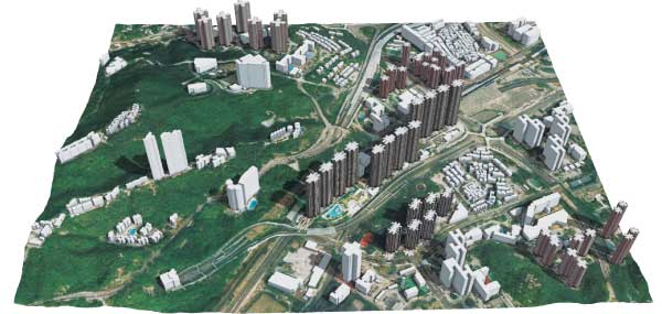
AAM has worked in Hong Kong for some years to build the city’s cache of 3D data. In 2011 AAM completed an extensive 3D city modelling project. AAM’s role was to provide spatially correct and photorealistic models, deployed in a versatile and functional 3D GIS. Read more.
 (1)")
")
")
")
")
")