


AAM was able to provide the NZ Transport Agency with LiDAR data and 20cm imagery.
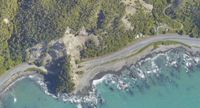
During the 14 November earthquakes in New Zealand, roads were cut and thousands of people were stranded in the South Island town of Kaikoura. Assessing and repairing road damage in the earthquake affected areas, so support services can reach residents, is among the NZ Government’s top priorities.
To assess the damage, which extended across the Canterbury and Marlborough regions, NZ Transport Agency commissioned AAM NZ to undertake an aerial survey of the impacted area along the state highway and rail corridor. The work was undertaken in conjunction with engineering company Opus and with the support of geoscience consultants GNS Science.
AAM collected both aerial photography (20cm resolution) and LiDAR data. You can view some of the maps produced from the data on the LINZ website site.
The datasets are being used by geotechnical and civil engineers to identify the location of landslides and volume of materials displaced in landslides, as well as the location and characteristics of the fault line ruptures.
AAM New Zealand is pleased to be able to help the Transport Agency in its restoration of transportation networks in the Kaikoura earthquake affected region.
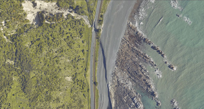
A fault line cutting Highway 1 and rail corridors near Kaikoura.
 (1)")
")
")
")
")
")