


The past few days have been difficult for so many people across Queensland. At AAM, we are working alongside the amazing efforts of various people to do all we can to respond to the various incidents across Queensland.
On January 29, as part of the response to the flooding disaster, an AAM aircraft was tasked to fly over the flooded areas of Bundaberg and capture the peak flood levels to ensure an accurate record of the affected areas. The following pictures were taken on-board during the capture of the aerial photography.
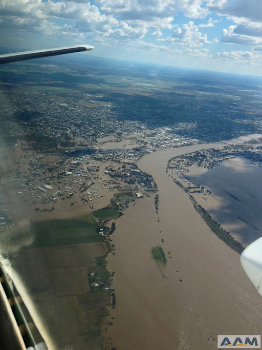
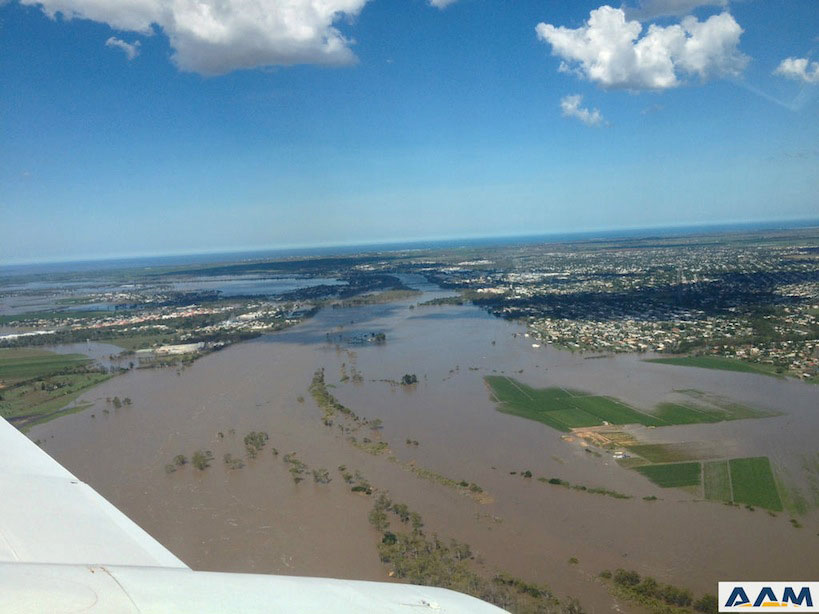
The images captured will be used extensively in the response and recovery work that will develop over the next few weeks as the town recovers from the terrible events that have occurred in the past few days. Once the images have been processed, they will be accessible via multiple protocols to enable the widest possible availability.
AAM GeoCloud
To ensure the quickest possible delivery and accessibility to all those who need the images, AAM will deliver the images via OGC Web Mapping Tiling Services (WMTS) through our AAM GeoCloud service. This delivery method provides an open interface that can scale rapidly to a large number of users, generate maps in a fraction of the time of other delivery protocols and will enable the widest accessibility to the data as quickly as possible. The data will then be integrated into various websites and GIS solutions used across the departments involved in the response and recovery process. Enabling smooth integration is critical to the success of disaster management. Hence, delivering data via the AAM GeoCloud as a WMTS service allows for the highest level of integration.
Geocortex enabling situational awareness
Alongside the capture of the images, AAM is doing all it can to support the work undertaken at the State Disaster Coordination Centre (SDCC) and State Operations Centre (SOC).
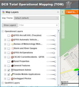
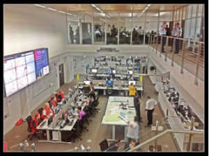 Since 2011, AAM has supported the Queensland Fire and Rescue Service GIS team and the development of the Total Operational Mapping (TOM) system. TOM operates with the Department of Community Safety’s other internal systems, bringing together information from various sources and organisations – such as the Bureau of Meteorology and Department of Transport and Main Roads – to create an interactive map of events as they occur across the state. This provides a vital tool that is used across all levels of the response teams working within the SDCC and SOC and on the ground. Real time events are recorded, such as the status of SES Requests for Assistance (RFA) and the Rapid Damage Assessment (RDA) reports, which draw from photos and flood level damage reports gathered by QFRS field staff.
TOM is based on the Geocortex software provided by AAM through Latitude Geographics and supported by customisations delivered by the AAM technical services team. This web based system is available to all Department of Community Safety staff, both on their desktops and as an HTML5 application on widely used tablet devices. By using an HTML5 application, live incident reports are available to all senior staff on their iPads anywhere, anytime.
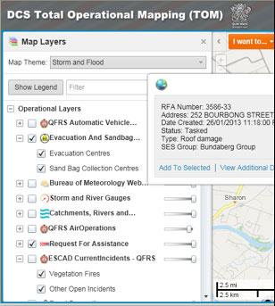
Live SES Requests for Assistance (RFA)from Bundaberg instantly available to all DCS staff and everyone at the SDCC
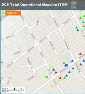
Rapid Damage Assessment (RDA) reports live from the field including photos of the damage from Cyclone Oswald
Reported incident pattern confirmed that it was a tornado that hit the town of Bargara.
By combining the rapid capture and delivery of the flood imagery as well as the ease of integration into the simple interface provided by Geocortex and the TOM application, those responding to the floods can access the information they need quicker than ever before.
AAM is proud to be working alongside the large number of people working tirelessly to do an amazing job responding to these events. For more information on how AAM is assisting with the disaster response, please contact info@aamgroup.com.
Please click here to full the view article published in GIM International.
 (1)")
")

")
")
")