


Sunshine Coast Airport Terminal Expansion Survey

Sunshine Coast Airport, represented by Rede Project Consulting, commissioned Woolpert to provide a Feature and Level Survey, 3D Laser Scan and Building Information Model (BIM) of SCA.
Cross Hybrid Survey Solution for Mining
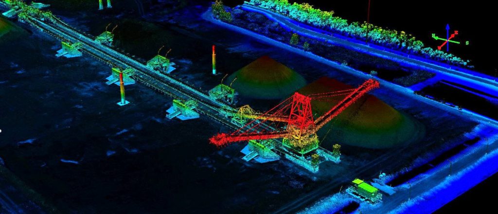
Woolpert are commissioned to complete recurring survey work for a mining company based in South East Queensland.
Bathymetric LiDAR for Waterway Management
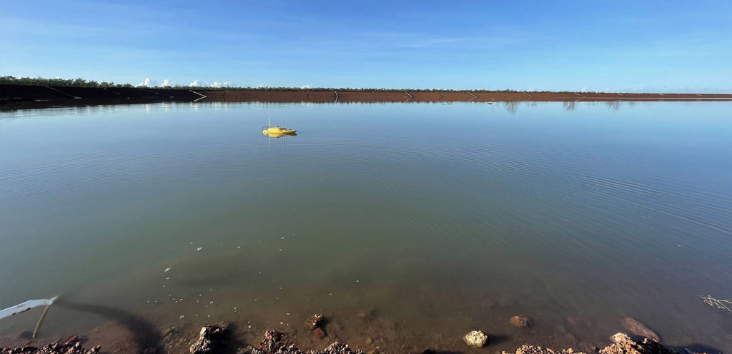
Bathymetric LiDAR for Waterway Management Woolpert were commissioned to survey for a project that involved 645 km2 over a coastal and waterways network in Eastern Australia. The site had a shallow drafted estuary, where bathymetric information was needed to maintain the usability and safety of the waterways. The area was subject to dynamic coastal processes. […]
Terrestrial Laser Scanning for the University of Melbourne

The University of Melbourne undertook redevelopment work to its site. In particular, the Old Commerce Building was demolished. Due to its façade being of significant heritage value, it needed to be retained whilst the remainder of the building was demolished. It was imperative that the construction works did not cause any movement and potential damage to the façade during the demolition of the building and the erection of a façade retention structure.
UAV Surveying Over Waste Depot Site
Woolpert was commissioned by Kimbriki Environmental Enterprises (KEE) to provide a Digital Terrain Model (DTM) and aerial survey to a cell surface on their Waste Disposal Depot. This helped calculate volume changes of specific site areas.
Surveying a Rail Corridor for Transport New South Wales
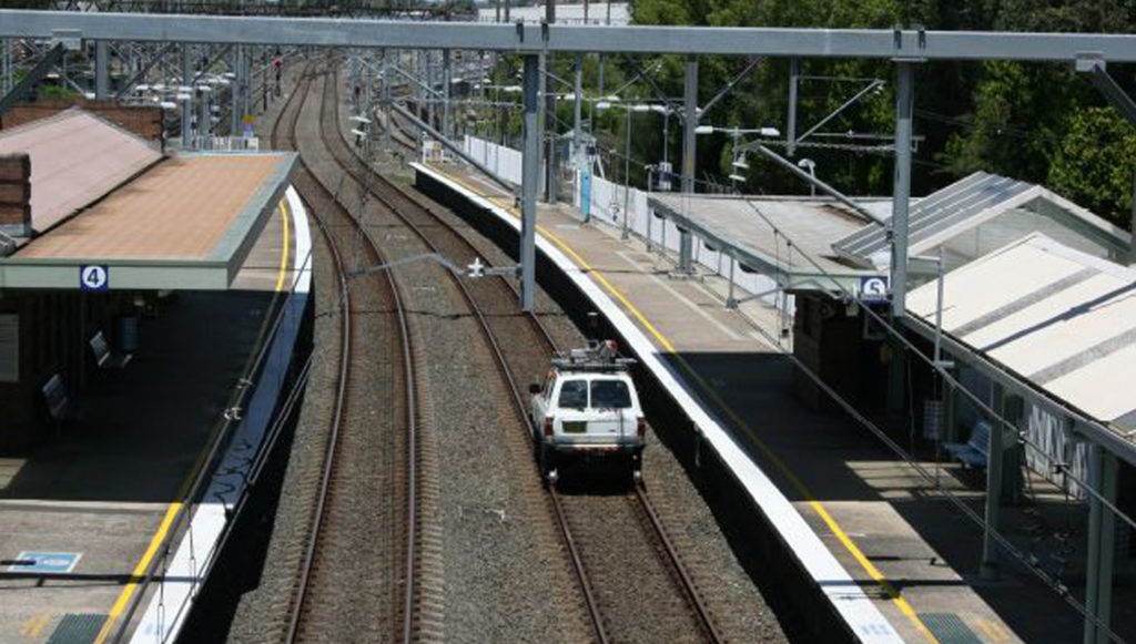
Woolpert were commissioned to conduct a 2.7km railway corridor Mobile Laser Scanning (MLS) survey to determine its Building Information Model (BIM) suitability. This required accurately defining assets and utilities with dense point cloud information for feature survey and 3D modelling production.
227 Toorak Rd Building Subdivision
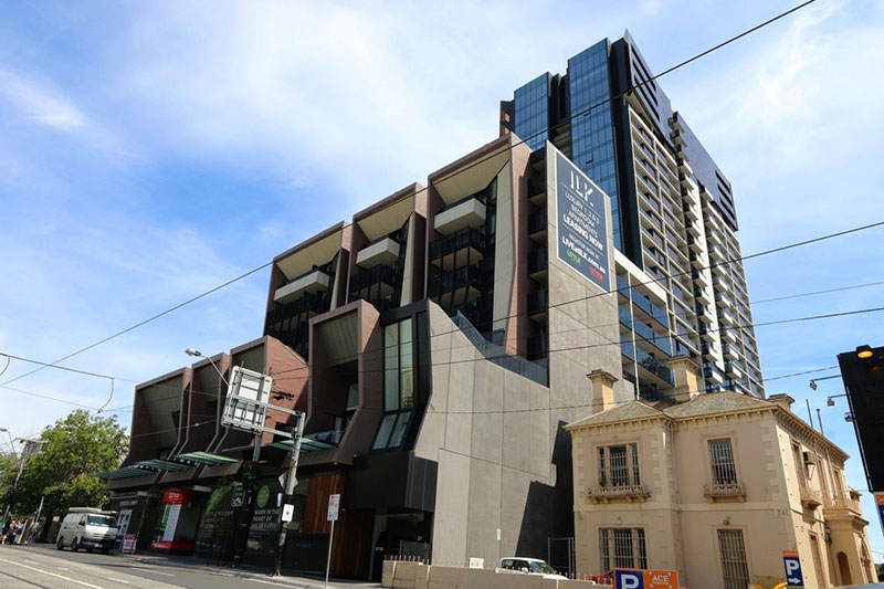
Overview The 227 Toorak Road development at South Yarra consists of 388 apartments, 6 retail spaces and 3 levels of parking. It’s also arguably one of Toorak Road’s most iconic buildings complimenting the locally-appreciated Chapel Street Precinct. AAM provided Land Survey services over the project’s duration. Situation The developer (Little Projects) required a Land Survey […]
Kowloon Terminus
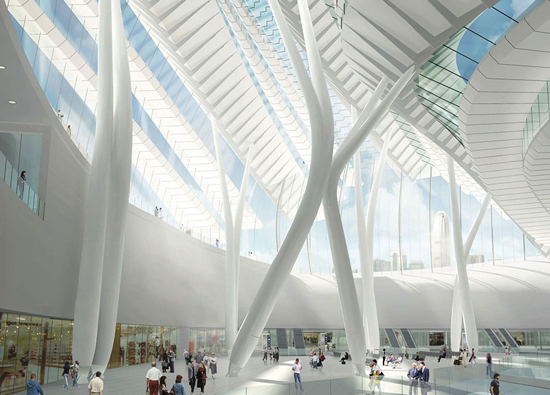
Qualifying accuracy & integrity of transportation infrastructure The Mass Transit Railway Corporation (MTR) and the Hong Kong Government constructed the world’s largest underground high-speed train terminus connecting Hong Kong and Mainland China. Consisting of 15 platforms and an iconic roof structure, it’s an engineering masterpiece formed from three lattice trusses supported at only nine locations. […]