


Sunshine Coast Airport Terminal Expansion Survey

Sunshine Coast Airport, represented by Rede Project Consulting, commissioned Woolpert to provide a Feature and Level Survey, 3D Laser Scan and Building Information Model (BIM) of SCA.
Lachlan River Bathymetric Survey
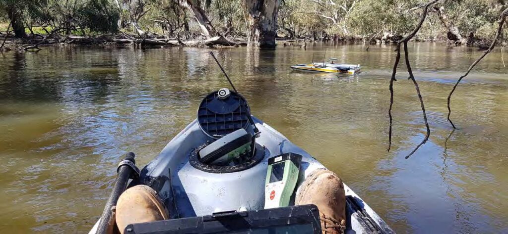
The Department of Planning and Environment (DPE) engaged Woolpert to conduct a bathymetric survey of portions of the bed of the Lachlan River and adjacent creeks.
Captains Mountain Wind Farm: LiDAR & Image Survey
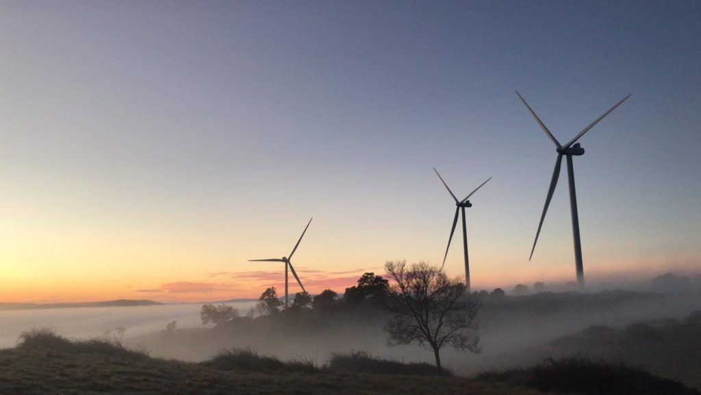
Woolpert was commissioned to acquire and process LiDAR and image data over the 180km2 Captains Mountain Wind Farm in Queensland for Vestas Asia Pacific (Vestas).
Cross Hybrid Survey Solution for Mining
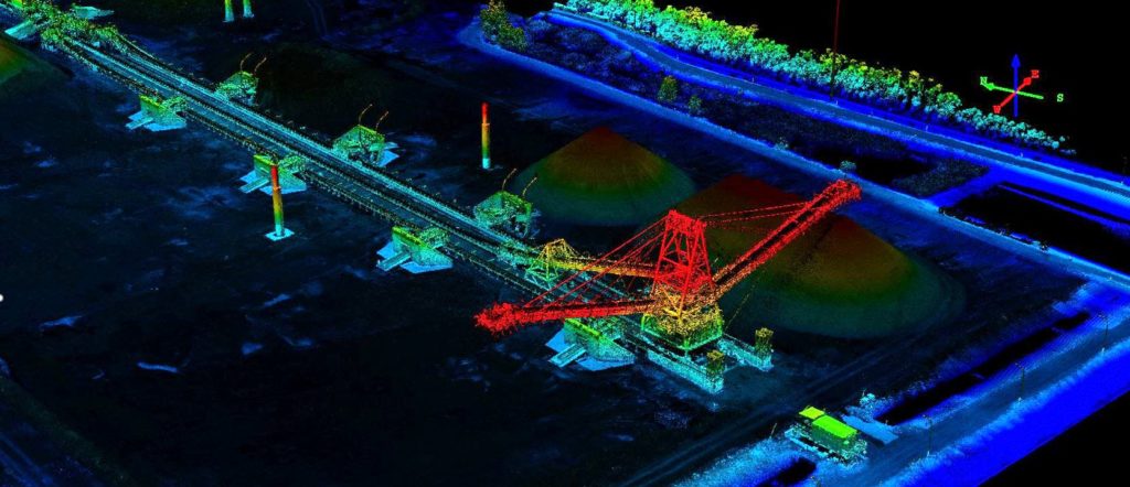
Woolpert are commissioned to complete recurring survey work for a mining company based in South East Queensland.
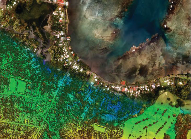
Bathymetric LiDAR for Waterway Management
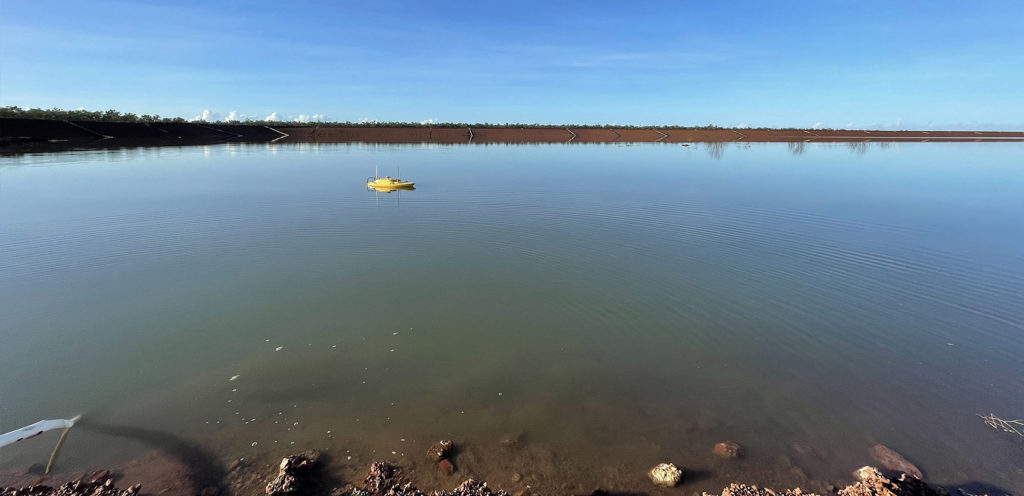
Bathymetric LiDAR for Waterway Management Woolpert were commissioned to survey for a project that involved 645 km2 over a coastal and waterways network in Eastern Australia. The site had a shallow drafted estuary, where bathymetric information was needed to maintain the usability and safety of the waterways. The area was subject to dynamic coastal processes. […]
APSEA Award – Bathymetric LiDAR for Pacific Islands
Woolpert received the highly coveted J.K. Barrie Award and the People and Community Award at the Asia-Pacific Spatial Excellence Awards.
Powerline Vegetation Study

Airborne LiDAR & asset modelling for effective powerline vegetation management Power Line Monitoring for the Energy Sector The safe operation of its 11,000 plus kilometre transmission network is the highest priority of this transmission owner and operator. With assets located in high fire danger areas, and sections of densely vegetated transmission line corridors at risk […]
Gold Coast Water Authority GIS Management
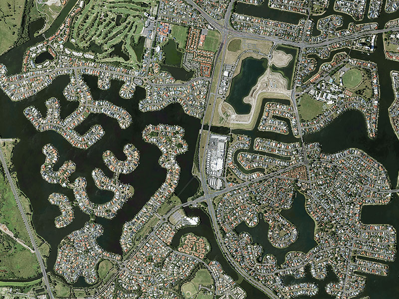
Gold Coast Water Authority GIS Management Enhancing community engagement through interactive GIS functionality Gold Coast Waterways Authority (GCWA) is the statutory body that manages the extensive waterways of Queensland’s Gold Coast from south of the Logan River to the New South Wales border. The 10-year GCWA Management Strategy calls for greater access to waterways, alongside […]