


3D City Modelling of Johannesburg

Woolpert was commissioned to undertake Aerial LiDAR, A3 Digital Orthophoto Imagery, Oblique Imagery, Rendered 3D Building Models and Building Footprints for the City of Johannesburg (CoJ) metropolitan area measuring 2,950 square kilometres.
Singapore Smart City

In 2014 the Prime Minister’s Office of Singapore unveiled Virtual Singapore1, a dynamic three-dimensional (3D) city model and collaborative data platform, including the 3D maps of Singapore. When completed, Virtual Singapore will be the authoritative 3D digital platform intended for use by the public, private, people and research sectors. It will enable users from different […]
Porirua City Council 3D City Models
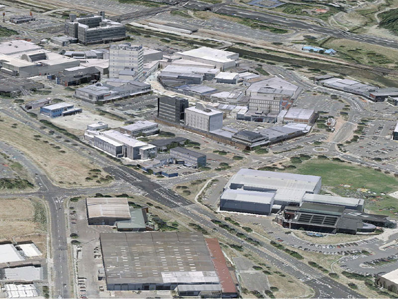
Dynamic city planning through advanced GIS capability Porirua is located on New Zealand’s North Island, one of four cities that constitute the Wellington metropolitan area. Porirua City Council (PCC) comprises a community of 52,000 people. PCC’s plan for 2015-25 will see the Council make a significant investment in new infrastructure and city centre development. AAM […]