Sunshine Coast Airport Terminal Expansion Survey
As the Sunshine Coast region continues to grow, our airport expansion was designed to meet the needs of the community and support the region’s economic growth. Critical to the airport expansion design was highly accurate and reliable spatial data, provided by Woolpert.
Karl Skoroszewski, Senior Project Manager
Rede Project Consulting
Background
Sunshine Coast Airport is Queensland’s premier regional airport at the heart of a thriving region. Located approximately 90 km north of Brisbane, Sunshine Coast Airport is one of the fastest-growing airports in Australia and is forecast to welcome 1.5 million passengers in 2022/23. The airport will service 16 destinations including Adelaide, Albury, Auckland, Avalon, Cairns, Cos Harbour, Mackay, Melbourne, Mildura, Newcastle, Port Macquarie, Rockhampton, Sydney, Tamworth, Townsville and Whitsunday Coast.
Sunshine Coast Airport is embarking on a period of significant growth and change, which will benefit all of South East Queensland. The first stage was completed in June 2020 with the opening of the new longer and wider runway and over the coming years the domestic terminal will double in size, there will be an expansion of the Aerospace Precinct and the Southern Gateway Precinct will start to take shape.
Challenges
Sunshine Coast Airport, represented by Rede Project Consulting, commissioned Woolpert to provide a Feature and Level Survey, 3D Laser Scan and Building Information Model (BIM) of SCA. The survey data needed to be integrated with the existing masterplan survey data of the whole airport property and surroundings.
.
1- Safety and security in the airport’s busy environment
The airport environment is hectic, with a forecast 1.5 million passenger movements per year and hundreds of aircraft movements each week. Besides navigating heavy trac, our team was required to deliver accurate surveying data with minimal impact on the airport’s everyday functions, especially when working in the public spaces.
Planning, flexibility, and co-operation was required for this project to be conducted thoroughly and extensively. Prior to starting fieldwork an initial plan of operation was drafted and submitted to the client, SCA management and security personnel. Through discussion, this plan was amended and then preliminarily approved by the parties.
Once the field work started this plan was amended further by unforeseen events such as adverse weather and unplanned VIP visits by the Prime Minister of Australia as well as other factors. Constant communication between all parties was required and the flexibility designed into the plan was used to ensure minimal impact on the schedule. This included conducting some surveys at night due to airport operations. This led to certain areas of the airport having to be surveyed over various days and moving between areas constantly. As a result of the planning and flexibility the total length of the survey period was not altered.
.
2- Processing captured data and with large amounts of noise
Due to restrictions of when surveying could be undertaken in certain areas capturing clean data was complicated. This is most evident in the terminal buildings where thousands of passengers were present and in secure areas large amounts of moving luggage and personnel. This provided a real challenge. The survey team had to constantly check that enough coverage of the structures was observed. And for the modelling team to filter and ignore the noise to ensure the creation of accurate LOD300 Revit building models.
Solution
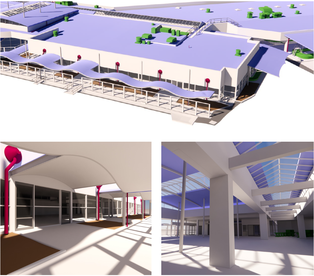
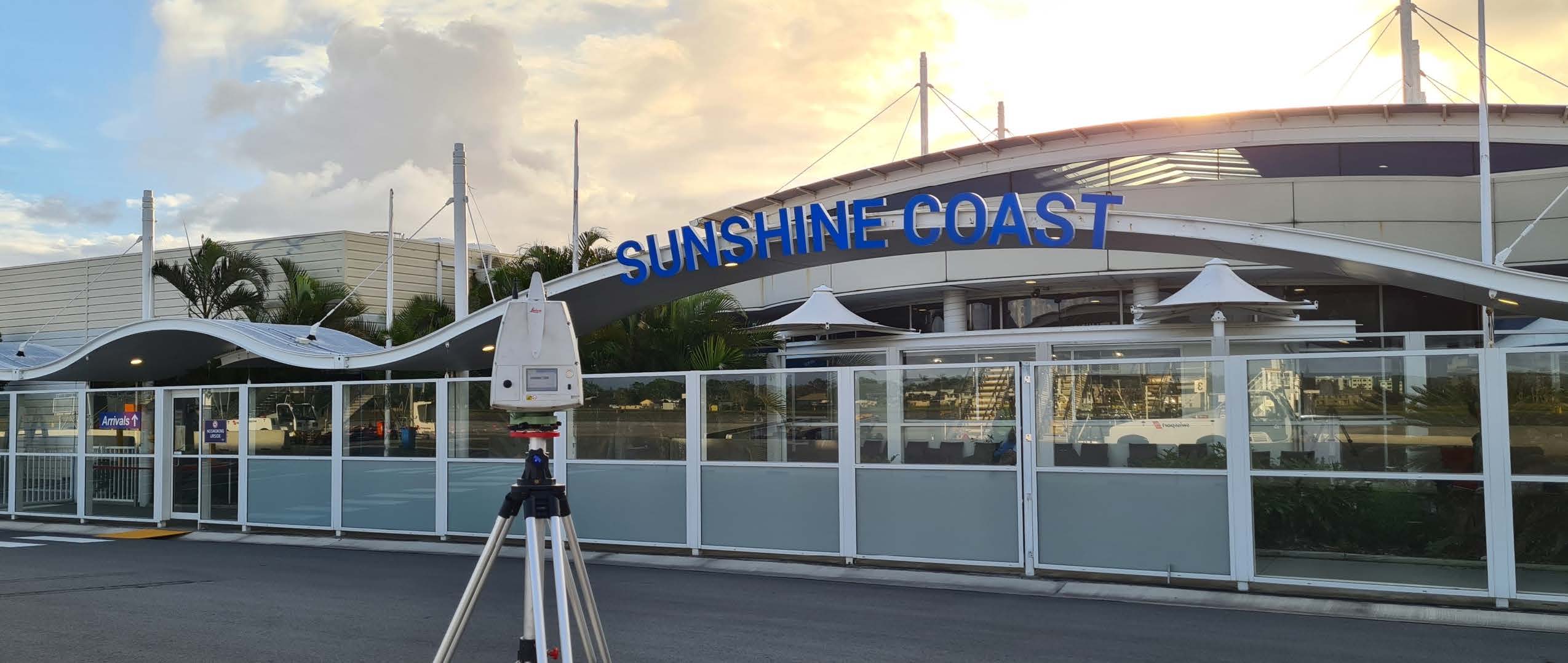
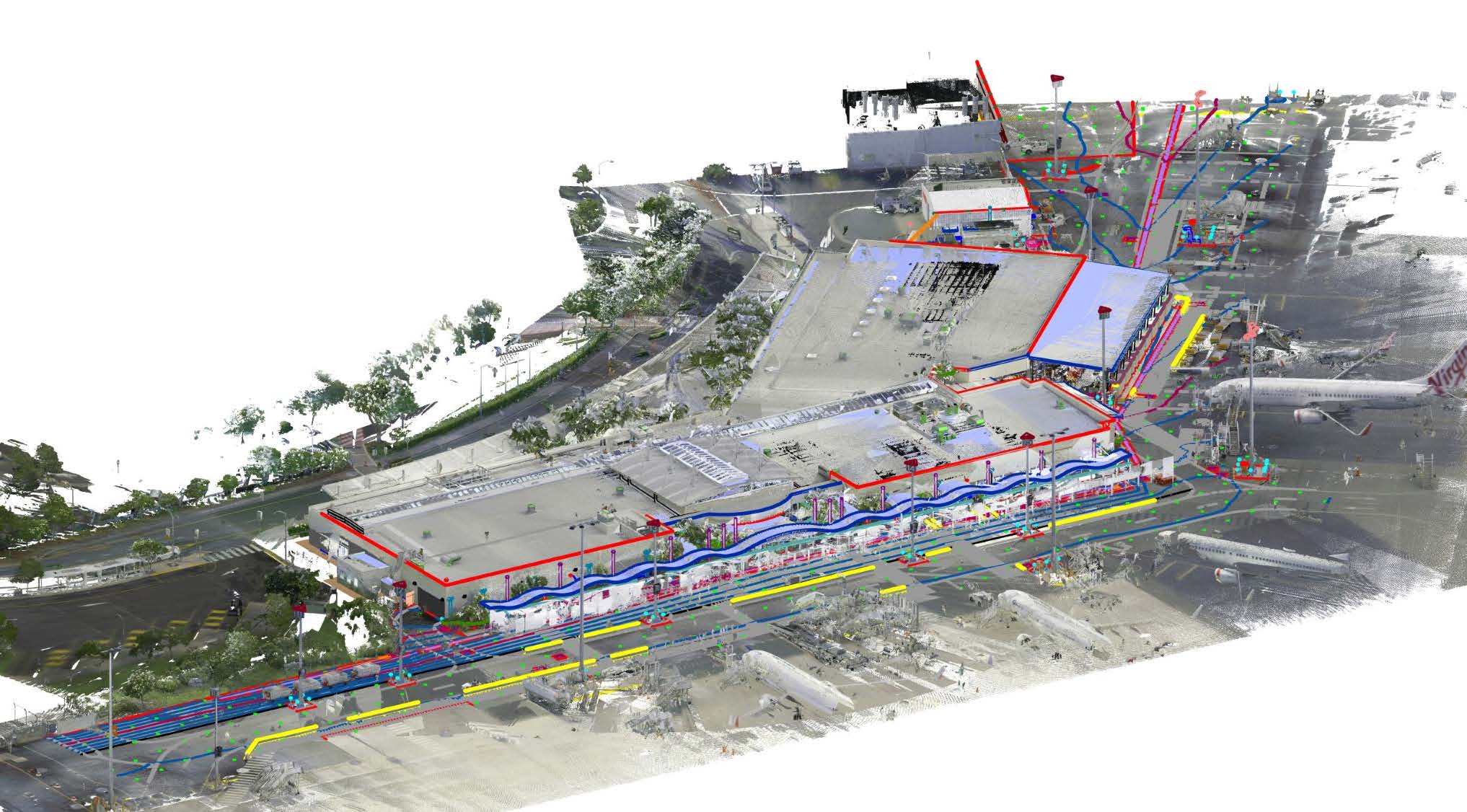
The site was surveyed using various equipment and methodologies to ensure accurate and comprehensive data. A Leica TS16 Total Station and Leica GS16 GNSS receiver were used to establish a rigid control network for accurate geospatial positioning of point cloud data taken from 456 scans across the site. The SCA control network was aligned to the MGA2020 coordinate system and with levels represented relative to Australian Height Datum (AHD) to ensure that AAM’s works would correlate with existing data already established as part of the broader masterplan.
Terrestrial Laser Scanning (TLS) was undertaken using a Leica RTC360, enabling speedy and comprehensive capture, whilst generating an accurate colourised point cloud as record of the site’s features. This technology allows for better documentation of as-built and existing conditions, primarily benefiting BIM outputs and the use of these within the Architectural, Engineering and Construction (AEC) Industry.
Results
Capturing and processing spatial data for Sunshine Coast Airport provided project management with the tools to accurately plan a major redevelopment. This data served as the basis for building and construction, allowing stakeholders to see the site in context and help reduce errors.
- Woolpert conducted Terrestrial Laser Scanning of 85% of Sunshine Coast Airport’s main terminal building, including ceiling scans. Additionally, an approximate 10,000 square metres of the adjoining airside topography was captured. Point Cloud data was provided in Autodesk Recap RCP and RCS formats.
- Woolpert delivered a full DWG feature survey or the airside topography, integrating with previous masterplan survey works undertaken by other contractors for the whole airport property and surrounds.
- CAD Drafting of the site Feature Survey and production of the LOD300 Revit model for the main terminal building was completed within 370 hours.