Application Development
Tailored GIS applications that meet user, integration, business and mobility requirements
.
Providing your complete geospatial app development needs
Woolpert is the most experienced developer of VertiGIS Studio applications in Australia, combined with extensive experience in Esri and open-source spatial technologies.
Maximise your investment in your GIS system
When your commercial-off-the-shelf product no longer meets your GIS requirements, Woolpert can extend and customise your applications and tools. This includes:
Web mapping integration
Connect your GIS to 3rd party business systems such as TechOne Property and Rating, TechOne Asset Management System, Civica Authority, InforPathway and HP Records Manager. Doing this will give greater transparency of your available data and the ability to manage 3rd party business systems data from the GIS if the system is capable of it.
Custom Tool Development
Extend out of the box tools to ensure your applications can do exactly what you need of them. The tools can be developed to meet your preferred GIS application – whether that’s VertiGIS Studio, Esri or open source.
Workflow design and development
This not only saves your users time by automating many of your business processes, but we’ll also make sure the user interactions in the applications are simple and easy to understand.
Mobile app development
Create more efficient field processes by using the latest technology. Field tasks can be complete in both connected and disconnected environments, and your users can access applications and complete activities even in remote locations.
Need more information on Woolpert’s application development?
Woolpert is the leading spatial application development consultancy in Australia
Your GIS applications may not be meeting your current requirements.
We can update them, so they do.
Your business processes might be cumbersome and time-consuming.
We can automate them and make the application interface user-friendly for a better experience.
Your authoritative datasets might be siloed in different business systems.
We can integrate them, so you have greater visibility of your existing customer data.
Or you may just want to make things easier for your field staff, by giving them technology that works in both connected and disconnected environments.
Woolpert can develop your VertiGIS Studio, Esri or open-source GIS applications to extend their capabilities and ensure your enterprise platform is meeting your business needs.
And while you might not know what can be customised or developed, we do.
We draw upon our knowledge of the latest technology and experience in data capture to deliver a system that will work for you.
FAQs
Woolpert can develop solutions using:
Visual studio, C#, VB.NET, HTML, JavaScript, Python, C/C++ OSG, OpenGL and WebGL.
This will very much depend on your organisation’s requirements, but you can generally expect the following process:
- Consult with your team and validate your requirements
- Design a solution that meets your needs
- Gain agreement on the solution and the desired outcomes
- Develop product in development environment
- Test and gain customer feedback
- Refine your product and test again
- Repeat feedback, refining, testing as agreed and/or required
- Deploy to production and supply documentation
- Handover, training and on-going support
Projects related
Singleton Council’s Upgrade from Geocortex Essentials to VertiGIS Studio
Singleton Council’s GIS team required upgrades to their Geocortex Series 4.13 system, while also progressing their Esri ArcGIS Server upgrades and launch of the associated ArcGIS portal environment.

Sunshine Coast Airport Terminal Expansion Survey
Sunshine Coast Airport, represented by Rede Project Consulting, commissioned Woolpert to provide a Feature and Level Survey, 3D Laser Scan and Building Information Model (BIM) of SCA.
Lachlan River Bathymetric Survey
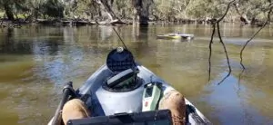
The Department of Planning and Environment (DPE) engaged Woolpert to conduct a bathymetric survey of portions of the bed of the Lachlan River and adjacent creeks.
