


Site Potential & Due Dilligence
Confidence in your spatial data. So you can make the right calls on site location and maintenance
Make the right calls with location intelligence updated through the infrastructure project lifecycle. Assess feasibility, explore your site’s terrain, routes and location. Design solutions using accurate data and analysis to support thorough due diligence.
.
TIMING IS EVERYTHING
“Data currency is key for the client, and we deliver on that.”
Glenn Morrison - AAM
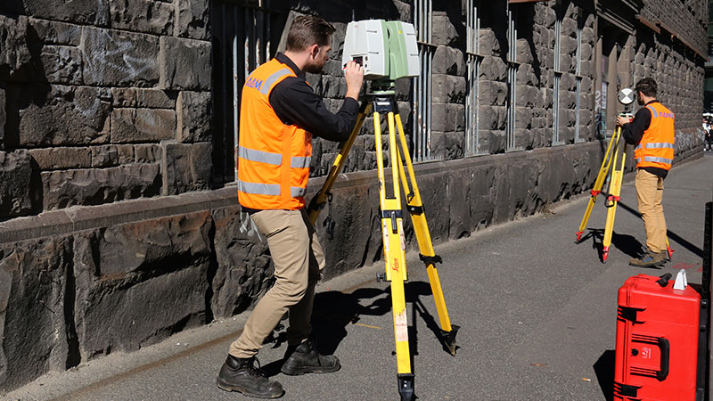
Accurate data supporting informed decisions
With offices in Melbourne, Sydney, Wollongong, Brisbane and Perth, our survey teams are available nationwide to provide you with quality, accurate data to support your business goals.
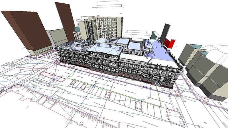
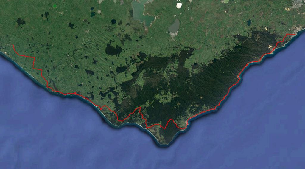
Position, establish, and manage your assets efficiently with digital data assets and comprehensive analysis from simple terrain modelling to detailed laser mapping over thousands of kilometres.
How we assess site potential and complete due diligence

STEP 1
LOREM IPSUM
Lorem ipsum dolor sit amet, consectetur adipiscing elit. Praesent non fringilla ipsum.
STEP 2
LOREM IPSUM
Lorem ipsum dolor sit amet, consectetur adipiscing elit. Praesent non fringilla ipsum.
STEP 3
LOREM IPSUM
Lorem ipsum dolor sit amet, consectetur adipiscing elit. Praesent non fringilla ipsum.
Why invest in geospatial site potential and due diligence services
- Informed design and decisions using digitised, geospatially accurate terrain mapping
- One-off or lifecycle site assessment and monitoring to get the information you need
- See what’s on the ground without obstruction from conditions or vegetation
- Deeper contextual insights by integrating geospatial data
- Streamline workflows and identify issues
- Predict, avoid, and mitigate risk
- Use visual data to improve communication and efficiency across teams
.
.
Why choose AAM for your site assessment and due diligence data
- Precision laser scanning and aerial photogrammetry
- LiDARnetics – AAM’s trademarked LiDAR processing system. LiDARnetics leverages artificial intelligence and machine learning to process data faster and more intelligently with each new job.
- High resolution, detailed topographic models
- Detailed imagery that can be processed with terrain data
- Accredited surveyors, manned aircraft and UAV pilots, LiDAR & imagery processing teams
Work with a team of experienced, qualified professionals
Our survey professionals and aerial pilots are licensed, registered, and safety-certified to deliver services when and where you need them.
ISO 9001 accredited Australian operations for effective quality management system
Licensed remote pilots for drone-assisted mapping and modelling
Registered and licensed surveyors for regulated projects
How we’ve done it before
For more than 60 years, we’ve delivered geospatial imaging solutions for clients in a wide range of industries, projects and environments.
The tools we use
Since we conducted our first aerial surveys half a century ago, our technology has evolved to a full suite of high resolution imaging devices, and manned and unmanned aerial and water craft.
- Aerial survey and photogrammetry
- Laser scanning
- 3D modelling
A COMPLETE SOLUTION
“We don’t just deliver the data and analysis and walk away. We stay engaged with our clients and offer guidance and advice.”
Glen Morrison - AAM
.