


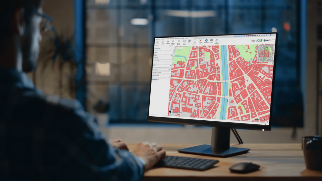
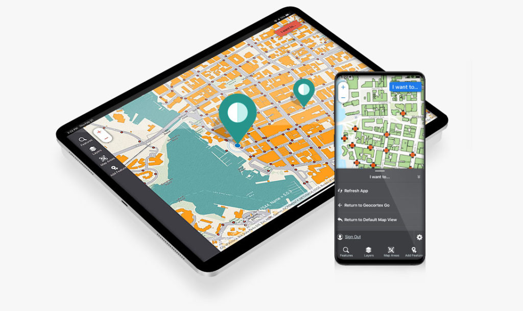
Transitioning to VertiGIS Studio from Geocortex Essentials
We are currently helping dozens of our customers make the transition through careful planning via our comprehensive Readiness Assessments which provide a clear roadmap and estimate to transition a customer’s Geocortex environment to VertiGIS Studio.
Laser Scanning, Modelling and BIM
Our Laser Scanning, Modelling and BIM Products Woolpert is an
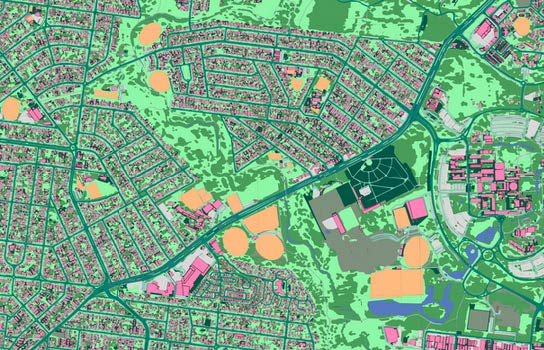
Ecopia 3D Land Cover powered by Woolpert
Partnering with Ecopia AI to map Australia’s top metropolitan areas

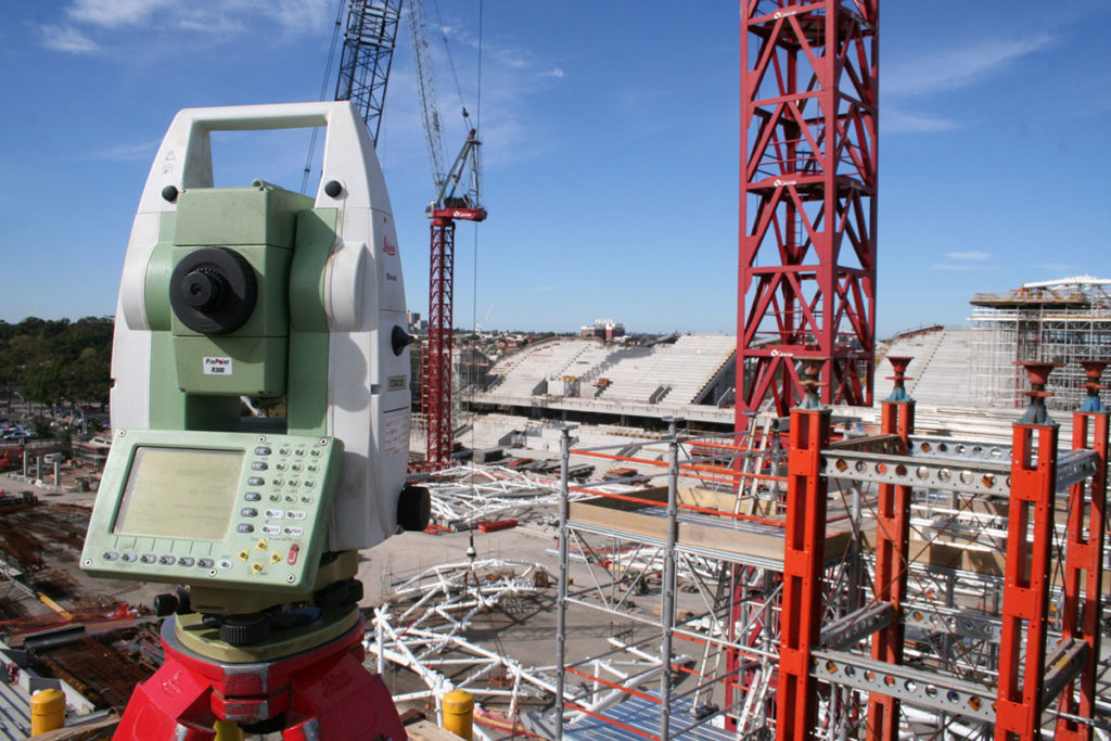
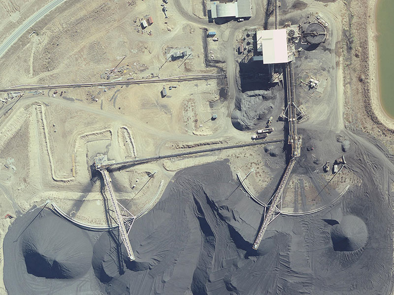
Aerial Survey
Woolpert delivers reliable aerial survey outputs, generated with state of the art technology, backed by many decades of experience. Your assets are captured in incredible detail, enabling you to make better informed decisions
Laser Scanning, Modelling and BIM
Our Laser Scanning, Modelling and BIM Products Woolpert is an
Geospatial Solutions
OVERVIEW Our Geospatial Solutions Considering geospatial information technologies or wanting
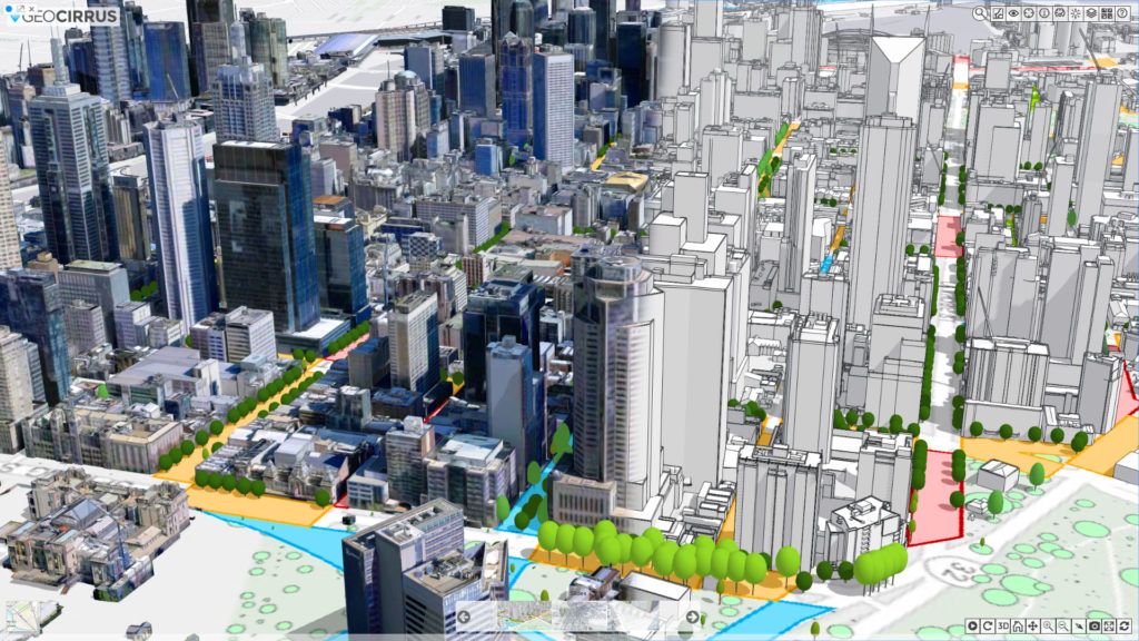
Geocirrus 3D Content
AAM has an extensive catalogue of 3D content. You can explore and purchase this content through the Geocirrus store. Geocirrus is where quality spatial content and convenience converge.
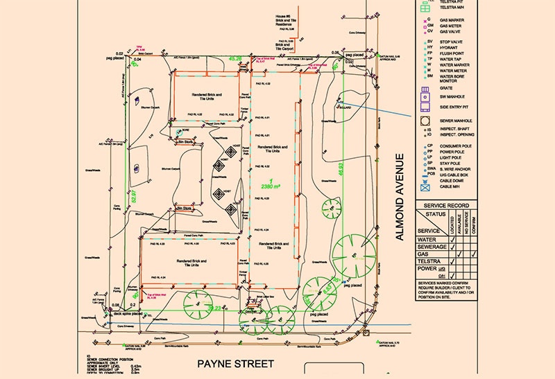
Cadastral Consulting
Cadastral surveying for land developers and major projects. Woolpert cadastral consultants are experts in land boundaries and can help maximise your property development.
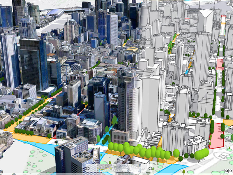
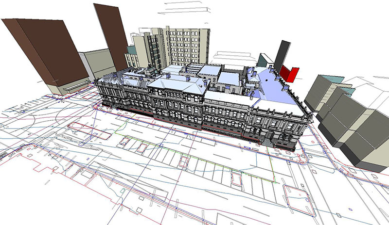
Mapping the Urban Landscape
Investing in a 3D digital twin of your environment allows you to plan, build, deliver, and assess the impact of your project before your team sets foot on the ground.

Smart City Solutions
Smart City Solutions guide change, manage risk, and deliver sustainable outcomes with high resolution 3D modelling.

Network Mapping and Analysis
When you need to map a large distributed network of assets fast, so you can plan and manage more efficiently and effectively.
Site Potential & Due Dilligence
When you need to accurately assess and analyse your site to maximise its value or ensure you meet stringent compliance issues.
Environmental Analysis
Expert environmental analysis reduces risk and maximises ROI with data-driven decision making at every stage.
Asset Management and Modelling
Know the lay of the land with less time in the field. Wherever you are in your project, the benefits of digitised assets are numerous and wide-ranging.

Singleton Council’s Upgrade from Geocortex Essentials to VertiGIS Studio
Singleton Council’s GIS team required upgrades to their Geocortex Series 4.13 system, while also progressing their Esri ArcGIS Server upgrades and launch of the associated ArcGIS portal environment.

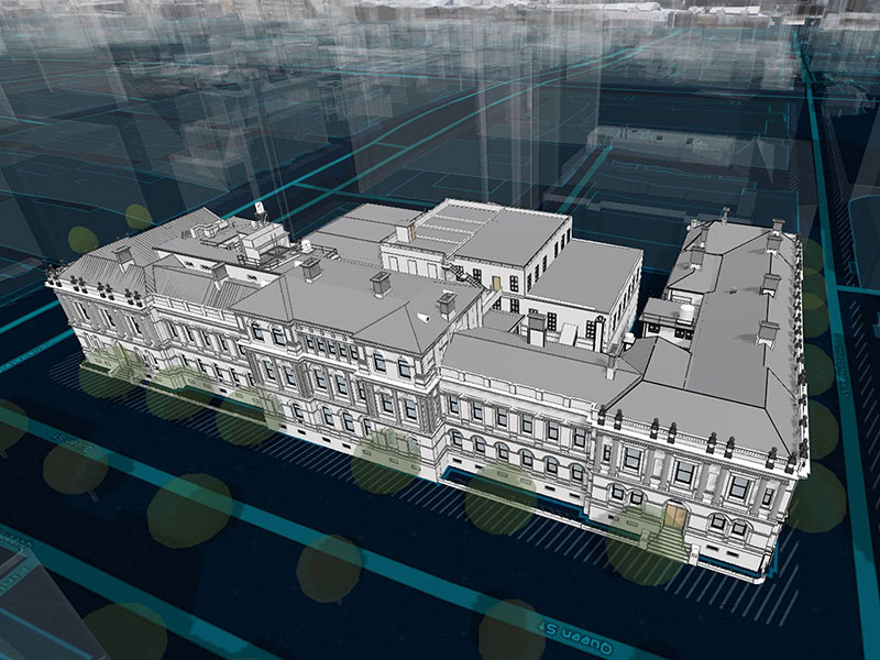
Sunshine Coast Airport Terminal Expansion Survey
Sunshine Coast Airport, represented by Rede Project Consulting, commissioned Woolpert to provide a Feature and Level Survey, 3D Laser Scan and Building Information Model (BIM) of SCA.
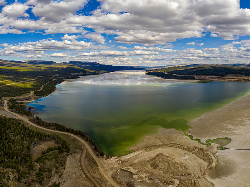
Lachlan River Bathymetric Survey
The Department of Planning and Environment (DPE) engaged Woolpert to conduct a bathymetric survey of portions of the bed of the Lachlan River and adjacent creeks.