


Ecopia 3D Land Cover powered by Woolpert
High-precision 3D & 2D vector layers for Australian cities
Partnering with Ecopia AI to map Australia’s top metropolitan areas in 3D
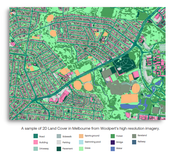
Woolpert is partnering with Ecopia to map Australia’s top metropolitan areas in 3D. Together, we are targeting 70% of Australia’s population with 3D mapping, including metropolitan areas such as Sydney, Melbourne, Brisbane, and Perth.
Leveraging Woolpert’s 10cm resolution aerial imagery, Ecopia will identify 15 land cover features. The resulting vector maps provide you with a detailed, accurate, and up-to-date foundational layer of geospatial data that represents the dimensional world as we know it.
Ecopia AI is revolutionising how artificial intelligence (AI) impacts the world of maps and geospatial data. Using proprietary advanced AI technology, Ecopia mines high-resolution imagery and automatically transforms pixels into geometrically accurate vector maps at a nationwide scale. Ecopia’s feature extraction process captures land class layers, including heights when applicable, with the precision you expect from a GIS professional, but the automation-level speed, scale, and efficiency of AI. This unique mix of accuracy and scale enables Ecopia to offer high-precision vector maps at significant cost savings compared to current workflows or market options.
Comprehensive land cover data for geospatial analysis & decision-making
Ecopia works with a growing list of agencies across all levels of government to map nationwide, statewide, and local communities at a speed, cost, and accuracy never before achievable. Leveraging Ecopia’s 3D Land Cover powered by Woolpert with your other first and third-party data sources can power strategic decision-making for a variety of critical geospatial workflows related to climate resilience, urban planning, broadband expansion, and more.
Flood modeling, mapping, & risk analytics
Use accurate surface delineation and 3D features to enhance flood modeling and inform mitigation tactics
Stormwater drainage & utility fee assessment
Utilise accurate impervious and pervious surface data layers to better understand stormwater runoff and calculate a fair fee structure based on per parcel impervious coverage
Green infrastructure planning & monitoring
Power green infrastructure projects by planning with more accurate as-is site plans, and incentivise citizens to embark on their own projects through rewards for positive per parcel surface change
GIS management
Fuel your GIS database with accurate planimetric layers that can be easily updated with every new image
Conservation monitoring & environmental management
Keep tabs on your community’s environment through accurate tracking of urban and green space coverage
Land use & urban sprawl analysis
Stay on top of your constantly growing and evolving communities by accurately categorising every square centimetre and using change identification to feed your analytics
Emergency management
Leverage geocoded 3D building footprints and ingress/egress routes in your next gen emergency response infrastructure so that frontline personnel can be accurately dispatched, navigate with safety and efficiency, and locate people in need faster
Transportation planning
Accurately maintain your road, driveway, parking, and sidewalk database to ensure that all citizens have access to safe mobility
.
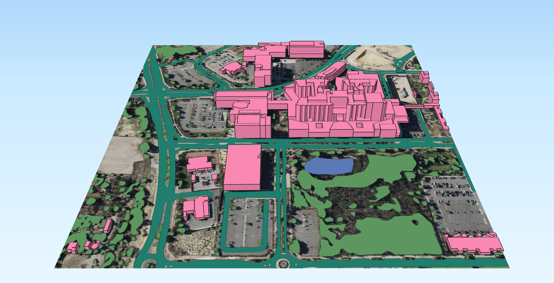
Explore Melbourne in 3D
To explore Ecopia 3D Land Cover powered by Woolpert in action, we can provide you with access to a 20km² dataset of Melbourne for evaluation purposes.
To obtain your link to the data, simply
.
Geospatial AI: Unleashing the Power of 3D Land Cover across Australia
Woolpert and Ecopia hosted a workshop at Locate23, titled ‘Geospatial AI: Unleashing the Power of 3D Land Cover across Australia’.
This fully subscribed session provided an introduction to Ecopia 3D Land Cover powered by Woolpert, a demonstration of this powerful platform and case studies of its use.
Leveraging AI to create 3D building models
A government organisation responsible for property and land information in Western Australia wanted to respond to their clients’ growing demand for fast and frequent spatial data delivery, without compromising on the high quality they required. They hypothesised that AI could help to achieve this, so they scoped a project to test this theory. The aim of the project was to determine what types of urban infrastructure could be automatically extracted from aerial imagery using AI and Machine Learning (ML) algorithms.
Applying our experience in AI and ML algorithms to spatial processes to increase workflow efficiencies, we partnered with Ecopia, and took just 12 days to extract, check and deliver the requested features. Without the use of AI, it would have taken approximately 50 weeks to achieve the same results.
By using AI, we delivered an approximate reduction of up to 40% in overall costs.
Find out more
Contact us to organise an obligation-free discussion about how Ecopia 3D Land Cover Powered by Woolpert can assist your projects.