


Solution Architecture & Enterprise GIS Consulting
Spatial strategy guidance, solutions and advice.
Get GIS strategy and implementation advice from the experts
Feeling limited by your current GIS usage? Unsure how to fit a new GIS system into your existing enterprise environment? Overwhelmed by your geospatial cloud migration and data accessibility needs?
Our team can assist you in the development of your geospatial strategy, GIS technology roadmap and accompanying work plan. We help you implement best practices to integrate geospatial information into your business processes.
Comprising highly-qualified GIS professionals, our expert team can design, architect and deploy Esri ArcGIS and Geocortex solutions to meet your geospatial solution needs.
.
GIS Support
If you are an existing client requiring support for your VertiGIS Studio, GIS or application development solutions – please submit a query below.
3 ways to use AAM’s enterprise GIS consulting services:
Go beyond the current GIS use
AAM can develop a GIS strategy that raises awareness for GIS use in new areas of business and maximise the return on your investment
Seek advice for geospatial cloud migration
AAM’s Hosted and Managed Services consultants can architect the right Geospatial cloud environment for your business providing scalability, elasticity and support whilst reducing on-premise infrastructure costs.
Improve data accessibility
We ensure the GIS is configured in such a way that data structures can be easily accessed via authorised integrations to other Enterprise systems.
GIS & BIM Manager
Aviation
Senior Urban Designer
Local government
National Sector Lead
Architect firm
Civil Engineer
Civil engineering & construction company
Senior GIS Analyst, Spatial Services
Local government
John Gibson
Senior GIS Analyst, Greater Wellington Te Pane Matua Taiao
Maximise your GIS potential with Australia’s leading Esri ArcGIS and Geocortex GIS consultancy
Whether you want to enhance your current GIS or are looking to deploy a new GIS – AAM is your one-stop GIS consultancy solution.
As the Australian distributor for Geocortex we work closely with VertiGIS to ensure your Geocortex needs are covered.
Our experienced team is at home in developing and implementing both the Geocortex and Esri ArcGIS platform. We can provide guidance on Geocortex and Esri ArcGIS roadmaps, potential advantages of new features for your business, assist with software upgrades, as well as system enhancements and deployments.
Our wide experience, across many industries and use cases, means we can make the tools deliver the insights that your business needs.
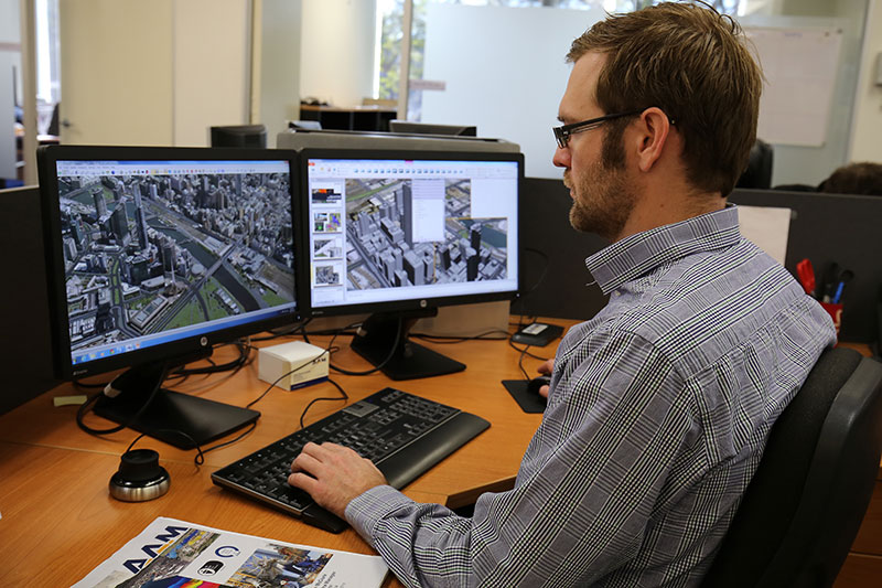
Our GIS consulting projects in action


GIS & BIM Manager
Aviation
Senior Urban Designer
Local government
National Sector Lead
Architect firm
Civil Engineer
Civil engineering & construction company
Senior GIS Analyst, Spatial Services
Local government
John Gibson
Senior GIS Analyst, Greater Wellington Te Pane Matua Taiao
Seamlessly integrate GIS into your enterprise systems
When implementing or upgrading to a new GIS system, it’s only natural that you will want to ensure the system will fit your existing enterprise environment.
Our team can provide guidance to ensure you have the most optimum GIS environment to support your geospatial strategy and its objectives as well as the current business needs of geospatial data users across the company.
We handle the integration of your server or web mapping system with a range of applications, data vendors and tracking devices including business systems such as Document, Asset, HSE, Property and Financial Management Systems; and dynamic feeds such as vessels, vehicles, assets and weather.
Ultimately, we find the most efficient and flexible structure into which all components of your existing GIS environment can be integrated.
Frequently asked questions about our enterprise GIS consulting service
There are many factors that determine when we can fly to capture your LiDAR data which can impact cost, such as:
* Air traffic control restrictions
* Weather conditions
* Tidal flows
* Angle of the sun
* Availability of the right aircraft and the right sensor for the job
Other factors that affect the cost of your airborne LiDAR survey include:
* Size of the survey area
* Distance of the survey area from air base
* Terrain conditions
* Level of accuracy required (which in turn is influenced by how you intend to use your LiDAR data)
* LiDAR processing considerations: larger and/or more complex data requires more time, computing power and/or human intervention to process.
Like any flight, our departure times depend on the weather.
We must also factor in our current pipeline of work and equipment availability. But if you need your data urgently, we have different options to meet your need. Talk to us about your project and we’ll work out a solution.
With our efficient LiDAR processing system, you can get your data quickly . Most projects take a few weeks to a few months depending on how much data there is, and how many servers are needed to process the data. We can put more servers on the job if you need the data urgently.
With UAV LiDAR, we can get up to 2000 points per square meter of resolution. With fixed-wing LiDAR we can get about 1-50 points per square meter of resolution, with an accuracy of <10cm. But your project might not need all the data we can get. The level of resolution and accuracy needed depends on the problem you need to solve and how you plan to use your LiDAR data.
We can supply these formats:
TIFF, ECW, RAW (full list coming)
We can translate the data to any format so if your required format is not listed here, get in touch. We can probably deliver in the format you need.
When deciding on whether UAV/drone technology is needed for a project, we consider the location, the size of the area being surveyed, and the resolution required. Some projects don’t need the type of clarity achieved through UAV. Some projects benefit with fixed-wing AND drone LiDAR. What we recommend, depends on the problem and the result you need.
Yes! Geocirrus (link to store) is our catalogue of premium geospatial data. In addition to LiDAR data we have aerial imagery, 3D models and mesh.
We supply the data under AAM’s license or to our clients’ IP.
Once our clients have received and accepted our priced proposal for their project, we initiate a formal project handover. A dedicated project manager talks to our client to clarify that both sides understand the aim and scope of the project. We schedule the appropriate aircraft and sensor to start gathering data, whilst sending regular updates to our clients as each major milestone is reached. Once all the data is captured we send it to our processing team. We process and translate the data into our client’s preferred format, then deliver it via a cloud-based platform or hard disk drive.
Expert GIS consulting services on-call
Schedule a call to see how we can support your GIS strategy.