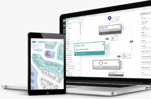
VertiGIS Studio Training
Learn from the VertiGIS Studio experts Train with us Whether you’re a beginner or a more advanced user, our training courses will provide you with
Solutions we provide for our customers.
Industries we specialise working with.
At AAM, we have been measuring and mapping our world for many years, since 1959 in fact. Our deep geospatial experience and expertise allows us to confidently push the boundaries in terms of content delivery and technology.
We work with our clients and partners to ensure the products and services we deliver are world class and tailored to suit.
Read more about the products and services we provide below.
Learn from the VertiGIS Studio experts Train with us Whether you’re a beginner or a more advanced user, our training courses will provide you with
We’re Australia’s leading UAV survey specialists. We deliver fast, accurate drone data that saves time and money.
AAM delivers reliable aerial survey outputs, generated with state of the art technology, backed by many decades of experience. Your assets are captured in incredible detail, enabling you to make better informed decisions
OVERVIEW Our Land Survey Products AAM has a proven history in providing land survey services that enable delivery of major projects. With more than 60
OVERVIEW Our Laser Scanning, Modelling and BIM Products AAM is an early adopter and investor in laser scanning, 3D modelling and BIM – an investment
OVERVIEW Our Geospatial Solutions Considering geospatial information technologies or wanting to expand your usage? AAM can identify ways in which geospatial data, tools and services
AAM has an extensive catalogue of 3D content. You can explore and purchase this content through the Geocirrus store. Geocirrus is where quality spatial content and convenience converge.
Cadastral surveying for land developers and major projects. AAM cadastral consultants are experts in land boundaries and can help maximise your property development.
We’re one of Australia’s largest ArcGIS experienced consultancies. Contact us for expert advice on how to make the most of your GIS technology.
Work from facts not assumptions. AAM delivers validated survey data, grounded in real-life measurements and locations, so you can make informed, data-driven decisions.
Functional, geospatially accurate solutions to better inform your projects. AAM’s experienced modelling team delivers quality, data-driven models you can rely on – a high quality, fit-for-purpose, on-time, on-budget solution.
Manage your complex mapping needs with ease. AAM’s Geocortex web mapping software saves you time and effort with its simple configuration and automated workflows.
Our team can assist you in the development of your geospatial strategy, GIS technology roadmap and accompanying work plan. We help you implement best practices to integrate geospatial information into your business processes.
AAM’s monitoring survey services go beyond just providing the raw data. Our expert team of monitoring surveyors will help you understand the data so you can derive actionable insights from it.
Expert Geocortex and Esri ArcGIS support at your fingertips. AAM’s Premium Support service gives you on-demand access to a team of geospatial technology experts.
AAM’s engineering survey service is defined by its expertise and speed. Backed by 60+ years of experience, our team always strives to get you accurate answers in the shortest time frame possible.
Reduce project costs and increase productivity. AAM’s cloud managed services lets you access all your spatial data, information and tools quickly and easily, anywhere you need.
Providing your complete geospatial app development needs. AAM are the most experienced developers of Geocortex applications in Australia, combined with extensive experience in Esri and open-source spatial technologies.
Underwater survey data and 3D modelling. AAM has built a reputation of providing accurate and informative data to engineers and scientists, helping them manage projects in and around bodies of water.
Reduce risk with accurate modelling and digital representations for your next project. AAM’s reputation as trusted advisors in the field of laser scanning provides data-driven certainty to all your planning and design needs.
Browse through Geospatial news, updates and insights from the AAM team.