Architecture, engineering and construction
From planning to asset management with real world modelling
From the world’s tallest buildings to major Australian building projects, our expert survey teams capture, process and analyse detailed spatial mapping to support shared decision making with access to shared data in the field and the office.
Get clear oversight of project environments, see the fine details of properties and assets, and monitor the environmental impact of the built environment as we face the challenges of designing, building and refurbishing a pandemic-proof world.
Why choose AAM for design and construction projects?
Our resources are positioned for flexible data capture, rapid processing and on-time delivery.
People-first safety
360° site visualisations perfect for safety inductions and site training.
Flexibility
Tailored data capture, format and analysis from 5x winners of the Asia-Pacific Spatial Excellence Awards.
Faster turnaround
Make faster decisions with data processed in the cloud with AI to deliver faster.
.
COMPREHENSIVE PROJECT OVERSIGHT
“From planning and design through to construction and engineering, built environment professionals get clear oversight of their projects in the format that suits them.”
Chris Horner - AAM
How we support the built environment
- Site selection and due diligence
- On-site active survey assistance
- Rural terrain mapping
- Heritage asset monitoring
- Large scale city models
- BIM streetscapes
- Greenfield and as-built surveys
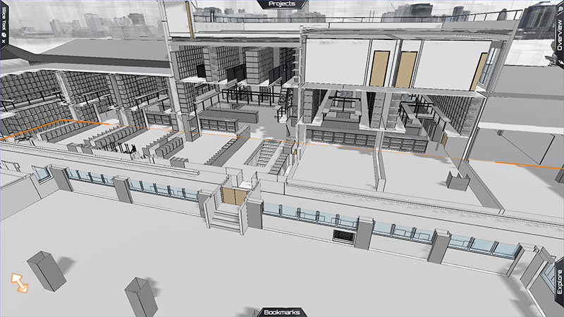
- Digital twin modelling
- Piling surveys
- In-ground service location and placement
- Smart Cities planning and implementation
- Stadium survey and modelling
- Basement footings, retention walls and structural positioning
.
3 steps from data capture to actionable insights
The technology might be advanced, but we move from capture to better decision making in 3 simple steps.
Capture the data
Analyse the data
Visualise the data
.
What to look for in AEC geospatial services
- End-to-end spatial intelligence solution
- Established field safety track record
- Long-term collaboration between field parties
- Share data anywhere, anytime in the office or in the field
- AI powered data analysis
- Customised datasets to meet project needs
- Geo-referenced asset imagery and location data
- ISO 9001:2015 certification of Australian operations
- Safety Management System: registered with Avetta
- COVID-safe practices
- Public indemnity and liability insurance
AAM projects
Our aerial and land survey teams provide support from site potential to due diligence through to as-built models.

Tools we use
Investing in cloud technology and AI supports faster, higher quality, and more efficient project outcomes.
- Digital twins
- BIM
- Laser Scanning
SHARING DATA
“Our technology makes it easy to share data, make informed decisions, and get everyone on the same page.”
Martina Smekalova - AAM
.


