


.
GIS Support
If you are an existing client requiring support for your VertiGIS Studio, GIS or application development solutions – please submit a query below.
Spend time with your clients, not your technology
Easily create, analyse, share and view maps and location information – anytime, anywhere and on any device
Make sure the customer service expectations of your clients are being met, with fast and reliable cloud managed services. As Woolpert manages all aspects of service delivery, including software release and environment management, you’re free to focus on delivering your project, by using your favourite applications and enjoying your work more.
Woolpert’s services include:
Hosting
Secured, managed servers to host your data, software and applications online so it will feel as if we’re on premise, but as a separate IT department.
Platform
Reduce staff numbers and resources, by moving your IT offsite. Draw on Woolpert’s experience in data capture to provide the most reliable and reputable options.
Support
Technical support and service level agreements underpin a faster, easier and lower cost alternative to inhouse IT teams, providing assistance when you really need it.
Local
Cloud-hosted in Australia for real-time support and minimised delays.
Flexible
Payment subscriptions available monthly, quarterly or annually to suit your project or business requirements.
Need more information on Woolpert’s cloud managed services?
Hosted Geospatial Managed Services Plans
Woolpert takes the complexity out of managing and maintaining geospatial technology resources with a range of hosted and managed cloud services plans
Woolpert can assist with managing all aspects of service delivery. We collaborate to provide control of IT infrastructure, assets, and software as required. Our hosted services use reliable, Australian-based infrastructure for maintenance, backup, and security. This allows you to focus on core responsibilities and customer service without worrying about details.
Services
-
User traffic (per month)
Storage
User traffic -
WebGIS supplied
-
Data base
-
GIS desktops
-
Load balancing
-
Fine-grained Security
-
Security*
-
Backup
-
Fully managed option
-
High-availability
-
Failover and DR
*All data protected by ISO27001 certification and Reverse Proxy
Web GIS
Intranet Web GIS and Web Mapping for specific applications
Standard
Premium
-
50 GB
250 GB -
-
-
-
-
-
-
-
-
-
-
100 GB
250 GB -
-
-
-
-
-
-
-
-
-
Enterprise GIS
Migrate organisation’s on-premise GIS to Cloud-hosted infrastructure.
Standard
Premium
-
1 TB
500 GB -
-
-
-
-
-
-
-
-
-
-
1 TB
500 GB -
-
-
-
-
-
-
-
-
-
Business Critical
High-availability and scalability
Failover and DR
Standard
Premium
-
2 TB
1 TB -
-
-
-
-
-
-
-
-
-
-
2 TB
1 TB -
-
-
-
-
-
-
-
-
-

Pay for what you use, when you use it
Don’t be restricted by the IT department and GIS resources they allow you access to.
If you need a service provider that allows you to scale up to meet demand peaks and troughs, while providing on-demand spatial content, tools and applications, AAM can tailor a solution to meet your needs.
Eliminate expensive, specialised software and the IT management overhead by outsourcing your infrastructure and software management. AAM managed service includes:
- Backups of Test and Production environments
- Management of data if required
- Server application monitoring
- Security setup and maintenance
- Virus and Malware scanning
- Geocortex and ArcGIS software release management, enhancements and service packs
- Geocortex custom module and workflow recompilation when required
- Incident reporting
Services
-
User traffic /m
Storage
User traffic -
WebGIS supplied
-
Data base
-
GIS desktops
-
Load balancing
-
Fine-grained Security
-
Security*
-
Backup
-
Fully managed option
-
High-availability
-
Failover and DR
Web GIS
Intranet Web GIS and Web Mapping for specific applications
Standard
Premium
-
50 GB
250 GB -
-
-
-
-
-
-
-
-
-
-
100 GB
250 GB -
-
-
-
-
-
-
-
-
-
NO. OF CLIENTS
XXXX+
NO. CLOUD SERVERS
XXXX
Services
-
User traffic /m
Storage (GB)
User traffic (GB) -
WebGIS supplied
-
Data base
-
GIS desktops
-
Load balancing
-
Fine-grained Security
-
Security*
-
Backup
-
Fully managed option
-
High-availability
-
Failover and DR
Enterprise GIS
Migrate organisation’s on-premise GIS to Cloud-hosted infrastructure.
Standard
Premium
-
1 TB
500 GB -
-
-
-
-
-
-
-
-
-
-
1 TB
500 GB -
-
-
-
-
-
-
-
-
-
Services
-
User traffic /m
Storage (GB)
User traffic (GB) -
WebGIS supplied
-
Data base
-
GIS desktops
-
Load balancing
-
Fine-grained Security
-
Security*
-
Backup
-
Fully managed option
-
High-availability
-
Failover and DR
Business Critical
High-availability and scalability
Failover and DR
Standard
Premium
-
2 TB
1 TB -
-
-
-
-
-
-
-
-
-
-
2 TB
1 TB -
-
-
-
-
-
-
-
-
-
AVERAGE SPEEDS
XXXX
CERTIFICATIONS
ISO27001.2005???
AAM’s cloud mapping services include the following:
SUB-CATEGORY
Lorem ipsum
- Lorem ipsum dolor sit amet
- Lorem ipsum dolor sit amet
- Lorem ipsum dolor sit amet
Lorem ipsum
- Lorem ipsum dolor sit amet
- Lorem ipsum dolor sit amet
- Lorem ipsum dolor sit amet
Lorem ipsum
- Lorem ipsum dolor sit amet
- Lorem ipsum dolor sit amet
- Lorem ipsum dolor sit amet
Need more information on AAM’s construction surveys?
Maintain control, without all the maintenance
Whether you’re moving your entire IT department off-site, or you just need an extra hand during a project, you still want to know you’re in charge.
The key to Woolpert’s success in cloud managed services, is a collaborative approach that provides you with as little or as much control of your IT infrastructure, assets and software, as you require.
Our experienced team of consultants will tailor a solution that suits your current, on-going or future needs.
What our clients say about us
GIS & BIM Manager
Aviation
Senior Urban Designer
Local government
National Sector Lead
Architect firm
Civil Engineer
Civil engineering & construction company
Senior GIS Analyst, Spatial Services
Local government
John Gibson
Senior GIS Analyst, Greater Wellington Te Pane Matua Taiao
Clients who use our Cloud Managed Services
Frequently Asked Questions
There are many factors that determine when we can fly to capture your LiDAR data which can impact cost, such as:
* Air traffic control restrictions
* Weather conditions
* Tidal flows
* Angle of the sun
* Availability of the right aircraft and the right sensor for the job
Other factors that affect the cost of your airborne LiDAR survey include:
* Size of the survey area
* Distance of the survey area from air base
* Terrain conditions
* Level of accuracy required (which in turn is influenced by how you intend to use your LiDAR data)
* LiDAR processing considerations: larger and/or more complex data requires more time, computing power and/or human intervention to process.
Like any flight, our departure times depend on the weather.
We must also factor in our current pipeline of work and equipment availability. But if you need your data urgently, we have different options to meet your need. Talk to us about your project and we’ll work out a solution.
With our efficient LiDAR processing system, you can get your data quickly . Most projects take a few weeks to a few months depending on how much data there is, and how many servers are needed to process the data. We can put more servers on the job if you need the data urgently.
With UAV LiDAR, we can get up to 2000 points per square meter of resolution. With fixed-wing LiDAR we can get about 1-50 points per square meter of resolution, with an accuracy of <10cm. But your project might not need all the data we can get. The level of resolution and accuracy needed depends on the problem you need to solve and how you plan to use your LiDAR data.
We can supply these formats:
TIFF, ECW, RAW (full list coming)
We can translate the data to any format so if your required format is not listed here, get in touch. We can probably deliver in the format you need.
When deciding on whether UAV/drone technology is needed for a project, we consider the location, the size of the area being surveyed, and the resolution required. Some projects don’t need the type of clarity achieved through UAV. Some projects benefit with fixed-wing AND drone LiDAR. What we recommend, depends on the problem and the result you need.
Yes! Geocirrus (link to store) is our catalogue of premium geospatial data. In addition to LiDAR data we have aerial imagery, 3D models and mesh.
We supply the data under AAM’s license or to our clients’ IP.
Once our clients have received and accepted our priced proposal for their project, we initiate a formal project handover. A dedicated project manager talks to our client to clarify that both sides understand the aim and scope of the project. We schedule the appropriate aircraft and sensor to start gathering data, whilst sending regular updates to our clients as each major milestone is reached. Once all the data is captured we send it to our processing team. We process and translate the data into our client’s preferred format, then deliver it via a cloud-based platform or hard disk drive.
Projects related
Singleton Council’s Upgrade from Geocortex Essentials to VertiGIS Studio
Singleton Council’s GIS team required upgrades to their Geocortex Series 4.13 system, while also progressing their Esri ArcGIS Server upgrades and launch of the associated ArcGIS portal environment.
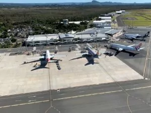
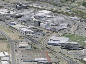
Sunshine Coast Airport Terminal Expansion Survey
Sunshine Coast Airport, represented by Rede Project Consulting, commissioned Woolpert to provide a Feature and Level Survey, 3D Laser Scan and Building Information Model (BIM) of SCA.

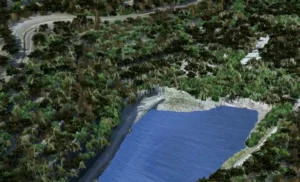
Lachlan River Bathymetric Survey
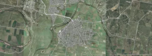
The Department of Planning and Environment (DPE) engaged Woolpert to conduct a bathymetric survey of portions of the bed of the Lachlan River and adjacent creeks.