Ultra High Density LiDAR for Gas Fields
Overview
This multinational resources company develops and operates natural gas (coal seam) reserves across Australia. Business operations involve managing natural gas leases and the extraction, liquefaction and transport of this resource. The company is also responsible for environmental monitoring and rehabilitation of land affected by their operations.
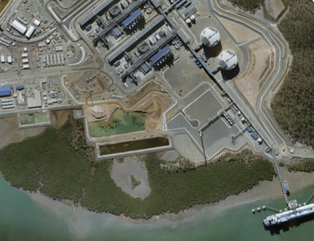
AAM’s superior aerial survey capability ensured the resources company was able to capture the full extent of their mining leases and tenements for enhanced operational and environmental management, as well as spatially accurate, ultra high-definition datasets of as-built infrastructure—a technical first in our industry.
The Challenge
Outdated asset data increased management costs, environmental and operational risks
AAM assessed the company’s needs as three-fold:
- To continuously manage and monitor their operational gas reserves and field operations, distributed across the state of Queensland
- To comply with relevant legislation regarding land and vegetation protection, as well as manage the environmental effects of their extraction operations
- To record their as-constructed plant and infrastructure
While the company maintained a regular aerial survey program, their spatial information and datasets needed updating due to the level of significant development over 9,000 square kilometres.
Obtaining current and exact spatial information was critical to the company’s ability to make informed business decisions, plan and manage operations appropriately, and in demonstrating environmental obligations were met.

The Solution
Ultra high-density LiDAR of as-built assets and broad-acre high-resolution imagery of field operations
AAM delivered custom aerial survey solutions to help the company minimise risk and maximise operational capacity.
- High-resolution LiDAR and imagery, from a broad-acre aerial survey, across more than 9,000 km2 of operational gas fields to monitor and plan on-going operations, and to manage environmental impacts
- Ultra high-resolution LiDAR (60–150 points/m) and imagery (2 cm) aerial survey to deliver high-definition spatial records of all as-built infrastructure. These datasets were the highest density ever supplied to a company in Australia
The Results
Detailed and accurate information for all operational assets
- Improved information for operational planning and analysis
- Enhanced decision-making for robust business outcomes
- Eliminated time-consuming and costly on-site asset inspections
- Reduced environmental compliance risks


