


Smart City Solutions
Build visionary cities with 3D digital mapping
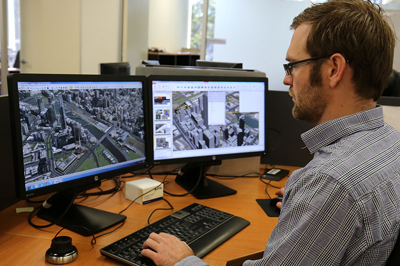
High resolution digital mapping lets you see the world as it is, in a highly visual 3D context providing a Digital Twin of the built environment.
3D Digital Twins support Smart Cities by providing better spatial analytics, scenarios and simulations.
Smart Cities of the future need to prepare for advancing technologies such as autonomous vehicles, 5G communications and IOT. These technologies all exist in the 3D space of the built environment that can be modelled accurately and effectively using Woolpert’s 3D solutions.
Woolpert’s Smart City solutions support the United Nations’ goals for sustainable cities of the future.
.
A FRAMEWORK FOR INFORMED DECISIONS
“Accurate 3D digital maps create a framework to do things better. We provide the map that the engineers and the lawyers can all agree upon and use to make decisions.”
Brian Nicholls - Woolpert
Boost efficiency and engagement with smart city modelling
With offices in Melbourne, Sydney, Wollongong, Brisbane and Perth, our survey teams are ready to support your smart cities project.
Beyond simple mapping, we deliver high-resolution, detailed 3D models and design virtual scenarios so you can explore every option. Our team joins the dots between the technology and UN Sustainable Development Goals for cities that embrace quality of life.
How we create spatial foundations for Smart Cities

STEP 1
Map the basics
- Capture LiDAR, aerial and oblique imagery
- Process Digital Terrain Models
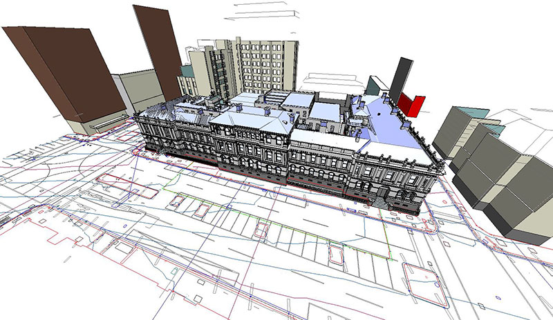
- Create 3D building models
STEP 2
Fill the gaps
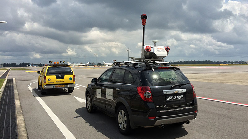
- Supplement with on-site and ground surveying where needed
- Utilise Mobile Laser Scanning (MLS)
- Create a 3D GIS of the entire city
STEP 3
Create a Smart City
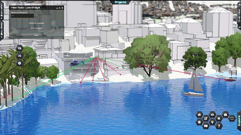
- Access accurate 3D models and BIM for informed decision making across city planning, design and management
- Monitor assets in real time with GIS applications
Why invest in Smart City solutions
- Create greener, cooler, more sustainable cities
- Smart maps inform smart decisions and design
- Futureproof planning with digitised, geospatially accurate infrastructure, terrain, and waterway mapping
- Plan your infrastructure with ‘What if’ location and scenario modelling
- Shared understanding created by 3D modelling and BIM between stakeholders for smoother communication and decisions
- City community health, safety and wellbeing
- Detailed imaging of what can’t be directly seen for resolution of complex problems
.
.
Why choose Woolpert for your smart city solutions
- License existing mapped data or customise what you capture for one-off projects
- Detailed aerial imagery and aerial photogrammetry
- Precise laser scanning, web and mobile mapping
- High resolution 3D modelling and BIM
- Choose your software format and LoD
- Dedicated project managers
Partner with accredited professionals
Our survey professionals are licensed, registered, and safety-certified. All data is analysed and modelled by a skilled and qualified information technology team.
ISO 9001 accredited Australian operations for effective quality management system
International Smart City mapping standards and conventions including CityGML, HTML5 and WebGL
Registered and licensed surveyors and pilots for regulated projects
How we’ve done it before
See how we’re helping smarten up cities by licensing existing mapped data or customising what you capture for one-off projects.
The tools we use
It still starts with aerial imagery. Our advanced solutions are underpinned by traditional survey and mapping expertise, and keep up with international standards for Smart City technologies across sensors, IoT and more.
- Aerial survey for LiDAR and Imagery data
- Mobile Laser Scanning (MLS)
- 3D and Building Information Modelling (BIM)
SOLID FOUNDATIONS
“Our smart cities skills have been built on really solid foundations of technology and traditional expertise. Making that connection gets you the outcome you need and ultimately helps make people's lives better.”
Chris Tanner - Woolpert
.