


Government
Customisable spatial intelligence solutions
Reduce risk, improve safety, and enhance community outcomes with precision mapping and expert spatial analysis. Use comprehensive location intelligence to develop end-to-end solutions for local, state and federal projects across economic development; emergency and disaster management; and asset optimisation.
Why choose AAM for government
We are 12 x winners of the Asia-Pacific Spatial Excellence Awards (APSEA).
Confidence
Quality, reliable data delivered safely and securely
Flexibility
A tailored capture, format or analysis solution for every project
ROI
Improved governance and operations for smarter investments
.
A HISTORY OF INNOVATION
“Our clients come to us with a problem and we have a whole toolkit of solutions that we adapt to fit the problem. If the solution doesn’t exist, we build it.”
Rohan Potter - AAM
How government uses geospatial services
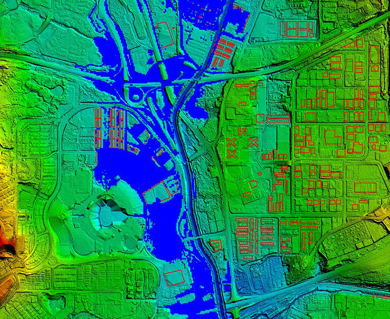
- Aerial photography for urban assessment and asset mapping
- High accuracy digital terrain models for flood analysis and development planning
- Assessment of climate change risk; monitoring condition of land, vegetation, and inland and coastal waterways
- Disaster response and emergency management – location-based data for rapid assessment and response
- Assess and monitor state infrastructure like transport networks, communication and utility installations, and water resources
- Data sharing within organisations via GIS for improved insight, collaboration and action
- Assessment and monitoring of heritage listed locations and assets
.
3 steps from data capture to actionable insights
The technology might be advanced, but we move from capture to better decision making in 3 simple steps.
Capture the data
Analyse the data
Visualise the data
.
What to look for in government geospatial services
- Customisable end-to-end spatial intelligence solution
- Proven risk reduction strategies
- Advanced survey tools and technology
- Data formats to suit your systems
- Flexible spatial data analysis solution
- Licensed survey and technical professionals
- Established aerial and field safety track record
- COVID-safe practices
- Public indemnity and liability insurance
- Accreditation for Australian operations - ISO 9001 Quality and ISO 27001 Information Security for a portion of hosted services SaaS
Supporting the government sector
Spatial intelligence supports local, state and federal governments to effectively manage resources and deliver meaningful impacts for communities.
Tools supporting government projects
An advanced toolkit to establish, monitor, and measure sustainable government and community initiatives.
- Aerial survey and LiDAR
- Geocirrus 3D models
- GIS and web mapping
WE'VE GOT THE EXPERIENCE
“Our ability to keep operating under COVID circumstances has been remarkable, particularly in the aerial survey area where we've had to move resources around across different state borders.”
Rohan Potter - AAM
.