


Asset Management and Modelling
Know the lay of the land with less time in the field
Wherever you are in your project, the benefits of digitised assets are numerous and wide-ranging. Before you start the design process or develop construction plans, AAM can capture spatial data to digitise your real world assets safely and with precision. Reduce your costs using new technologies combined with the expertise of our spatial professionals.
.
A SINGLE POINT OF TRUTH
“We're all about capturing the data as is: the real world, the single point of truth for a moment in time.”
Ryan Kent - Business Development Manager
Make the right call with data-driven decision making
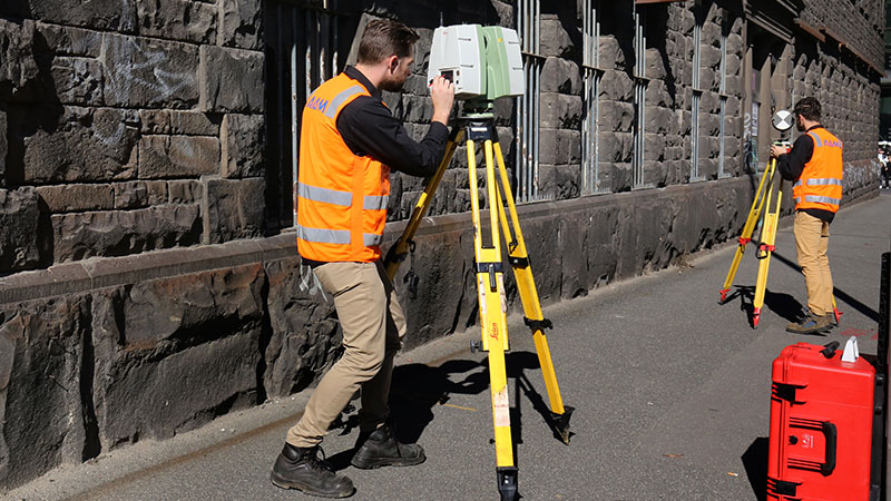
With offices in Melbourne, Sydney, Wollongong, Brisbane and Perth, our survey teams are available nationwide to get to your project on time and with ease to capture your real world assets.
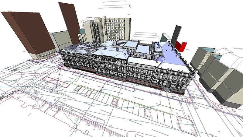
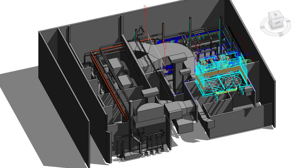
From simple floor plans to complex 3D geometry of assets and sites, our team creates bespoke, designer-friendly maps and models optimised to your project needs and budget.
Why invest in accurate asset modelling
- Point Cloud Capture = Less Time On Site = Reduced Costs
- Digitised, geospatially accurate asset models enable informed design and decision making
- Get the information you need, when you need it. We will model and record your sites’ conditions as required
- A detailed record of your Heritage Site(s) will assist refurbishment
- You can monitor your assets throughout the project lifecycle
- Can be used for clash detection and determining clearances
.
.
Why choose AAM Group
- We understand our clients needs
- Advanced laser scanning, 3D modelling and BIM
- Flexible delivery formats and Model LOD
- Experienced Geospatial Professionals
- Timely delivery on projects, large and small
Taking your Project from Start to Finish

STEP 1
PLAN
Projects are allocated to a specialist team to ensure scope items are understood and met.
STEP 2
CAPTURE
Project extents are captured using the latest in advanced surveying technology.
STEP 3
CONVERT
The resulting dataset is converted into a functional, intelligent and rationalised digital asset, with numerous formats available.
Work with a licensed provider where safety comes first
Site-specific safety training means our team of 80+ survey professionals can be rapidly deployed for time-critical projects.
ISO 9001 accredited Australian operations for effective quality management system
Licensed remote pilots for drone-assisted mapping and modelling
Registered and licensed surveyors for regulated projects
Previous Experience
Data capture is critical – but it’s also important to understand features and recognise connections that can’t be seen from the scan data alone. That’s where our expertise comes into play.
CUSTOMISED SOLUTIONS
“We're flexible about creating solutions that are customised for budget and timeframe - and make sense for everyone.”
Chris Horner - Modelling Manager
.