


Geospatial Data Supports Energy Transition
Background
The Central-West Orana Renewable Energy Zone (CWO REZ) will unlock at least three gigawatts of new network capacity for replacement generation for New South Wales (NSW). EnergyCo is responsible for leading the delivery of REZs as part of the NSW Government’s Electricity Infrastructure Roadmap. Woolpert was engaged to provide aerial and terrestrial geospatial datasets to support detailed design and approvals.
Client
EnergyCo
Location
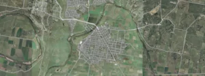
Central-West Orana region, New South Wales, Australia
Challenge
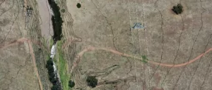
The project area of interest spanned over 2,000km2. Woolpert deployed both aerial and ground based survey teams to efficiently collect the required data within the project timeframes. This involved:
- Ground based topographic survey using total stations and GNSS at specific locations assisted with design items such as bridges, road upgrades, and intersections.
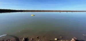
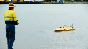
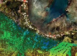
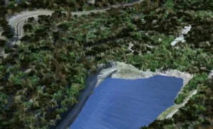
- Bathymetric survey in waterways throughout the project area to support hydrographic assessment and earthworks design activities.
- Aerial LiDAR and imagery was captured to provide datasets including a detailed Digital Elevation Model (DEM) to support engineering assessment and design works. High resolution imagery also aids others development aspects including environmental assessment.
Purpose
Support the detailed design and operation of CWO REZ infrastructure in line with the NSW Electricity Roadmap
Solution
Topographic survey
Bathymetric survey
Aerial LiDAR and imagery
Services
Solution
Survey capture of the CWO REZ involved various moving parts, equipment, and methodologies to deliver all three packages required.
- Sonar derived bathymetric depth data in water bodies: Woolpert used dual frequency single beam echosounder (SBES) equipment deloyed in unmanned surface vessels (USVs) to acquire acoustic depth measurements for accurate measurements with minimal disturbance to the environment.
- Aerial LiDAR & Imagery: Woolpert utilised a dedicated aerial survey aircraft equipped with a Optech Galaxy PRIME LiDAR sensor and PhaseOne camera to capture high density LiDAR data with concurrent 10cm GSD imagery.
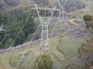
- Detail & Feature Survey from above: For areas where it was not possible for ground survey teams to access, Woolpert utilised their aerial LiDAR and imagery systems to capture data safely without needing physical access on the ground. This included mine sites and transmission line corridors.
Benefits
- Small remotely operated watercraft with bathymetric sensors help reduce environmental footprint.
- Aerial sensors collected high density LiDAR over areas with limited ground based access and with minimal disruption to the community.
- Woolpert’s cloud based LiDARnetics processing suite utilised machine learning to enable rapid, accurate processing of LiDAR and imagery data for quick delivery within required project timeframes.
Additional Resources
Results
Woolpert’s multi-disciplinary team enabled EnergyCo to acquire all necessary data via a single contractor. This reduced overheads including contract administration and ensured alignment of data from all sources. The datasets provided by Woolpert are a vital component in the construction and operation of CWO REZ infrastructure to support the NSW Electricity Roadmap.