Terrestrial Laser Scanning and BIM for Royal Melbourne Hospital
The Overview
An extension project was actioned for The Royal Melbourne Hospital (RMH) to increase its service capacity. This entailed adding four floors into the buildings facing Grattan Street, as well as two link-bridges connecting the hospital’s South to the new Victorian Comprehensive Cancer Centre.
The builder possessed a current Building Information Model (BIM) based upon information of unknown accuracy or quality.
The Situation
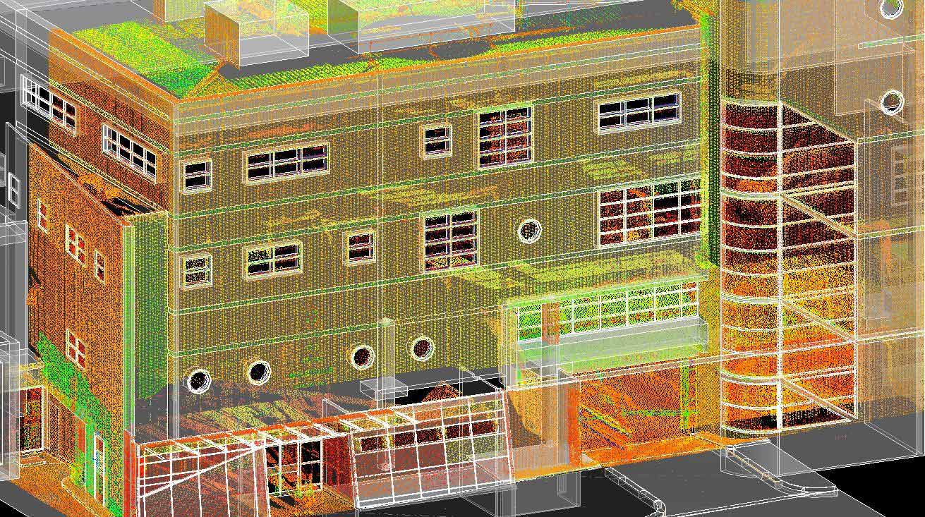
Limited confidence regarding its accuracy delayed the project, with AAM proposing a solution to undertake a Terrestrial LaserScan (TLS). This as-built data would then be used to upgrade the BIM contents and detail to a more suitable level.
.
.
The Action
We undertook a TLS allowing use of the RMH BIM to continue. This improved the timeframes, cost and associated benefits of the entire project. The laser scan also proved invaluable in upgrading the BIM’s accuracy, through its enhanced ability to acquire site information.
Many windows and columns were displaced by up to 150mm from their actual position, detected by comparing the as-built point cloud with the existing BIM. AAM then updated and created Modelled Elements directly in Revit.
The Results
Upgrading the BIM ensured the model was accurate enough for construction. AAM subsequently worked alongside the architects confirming the veracity of the BIM, verifying or amending critical interfaces in regard to the new building.
TLS improves documentation of as-built drawings and existing conditions. Its resulting 3D visualisations also allows clients to view historic preservation and site context respective to new projects.