


Captains Mountain Wind Farm: LiDAR & Image Survey
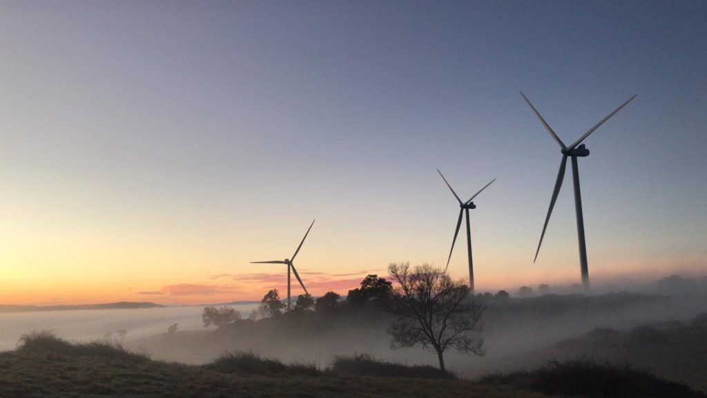
Woolpert was commissioned to acquire and process LiDAR and image data over the 180km2 Captains Mountain Wind Farm in Queensland for Vestas Asia Pacific (Vestas).
Cross Hybrid Survey Solution for Mining
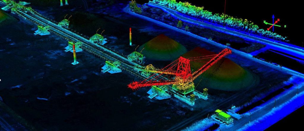
Woolpert are commissioned to complete recurring survey work for a mining company based in South East Queensland.
Singapore Smart City

In 2014 the Prime Minister’s Office of Singapore unveiled Virtual Singapore1, a dynamic three-dimensional (3D) city model and collaborative data platform, including the 3D maps of Singapore. When completed, Virtual Singapore will be the authoritative 3D digital platform intended for use by the public, private, people and research sectors. It will enable users from different […]
Aerial Survey of Gold Coast Stadium
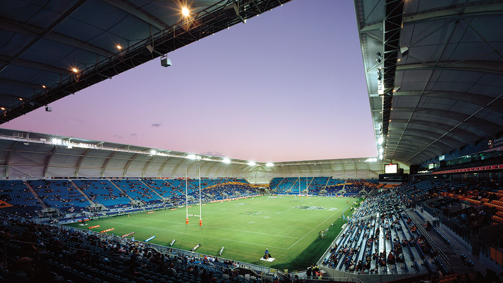
Overview We were commissioned as the survey consultant for the Gold Coast Stadiums construction project, requiring specialised surveying experience from dilapidation reporting to aerial and design surveys to land title registration. Situation Following Carrara Stadium’s redevelopment, all that remains of the old stadium are six light towers. Original plans included two grandstands on either side […]
UAV Surveying Over Waste Depot Site
Woolpert was commissioned by Kimbriki Environmental Enterprises (KEE) to provide a Digital Terrain Model (DTM) and aerial survey to a cell surface on their Waste Disposal Depot. This helped calculate volume changes of specific site areas.
Bundaberg Emergency Flood Response
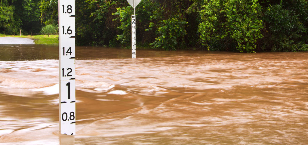
Overview Australia experiences natural disasters every year with Bundaberg, Queensland enduring an extreme weather event that delivered unprecedented flooding across the region. Reliable spatial data is critical to support the protection of life and property, as well as developing strong partnerships between response teams, government agencies and consultants. Situation Capturing Queensland’s aerial imagery proved challenging […]
Porirua City Council 3D City Models
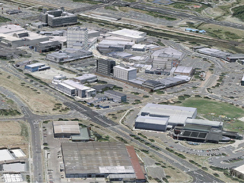
Dynamic city planning through advanced GIS capability Porirua is located on New Zealand’s North Island, one of four cities that constitute the Wellington metropolitan area. Porirua City Council (PCC) comprises a community of 52,000 people. PCC’s plan for 2015-25 will see the Council make a significant investment in new infrastructure and city centre development. AAM […]
Ultra High Density LiDAR for Gas Fields

Ultra High Density LiDAR for Gas Fields Overview This multinational resources company develops and operates natural gas (coal seam) reserves across Australia. Business operations involve managing natural gas leases and the extraction, liquefaction and transport of this resource. The company is also responsible for environmental monitoring and rehabilitation of land affected by their operations. AAM’s […]
Powerline Vegetation Study

Airborne LiDAR & asset modelling for effective powerline vegetation management Power Line Monitoring for the Energy Sector The safe operation of its 11,000 plus kilometre transmission network is the highest priority of this transmission owner and operator. With assets located in high fire danger areas, and sections of densely vegetated transmission line corridors at risk […]