


Sunshine Coast Airport Terminal Expansion Survey

Sunshine Coast Airport, represented by Rede Project Consulting, commissioned Woolpert to provide a Feature and Level Survey, 3D Laser Scan and Building Information Model (BIM) of SCA.
Cross Hybrid Survey Solution for Mining
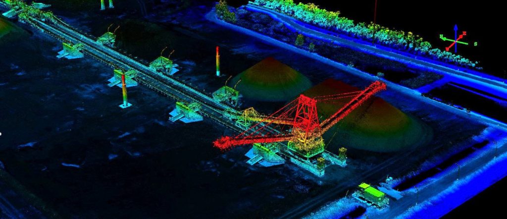
Woolpert are commissioned to complete recurring survey work for a mining company based in South East Queensland.
Terrestrial Laser Scanning for the University of Melbourne

The University of Melbourne undertook redevelopment work to its site. In particular, the Old Commerce Building was demolished. Due to its façade being of significant heritage value, it needed to be retained whilst the remainder of the building was demolished. It was imperative that the construction works did not cause any movement and potential damage to the façade during the demolition of the building and the erection of a façade retention structure.
UAV Surveying Over Waste Depot Site
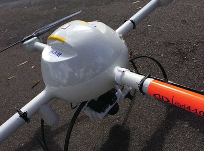
Woolpert was commissioned by Kimbriki Environmental Enterprises (KEE) to provide a Digital Terrain Model (DTM) and aerial survey to a cell surface on their Waste Disposal Depot. This helped calculate volume changes of specific site areas.
Brookfield Rail Line Survey
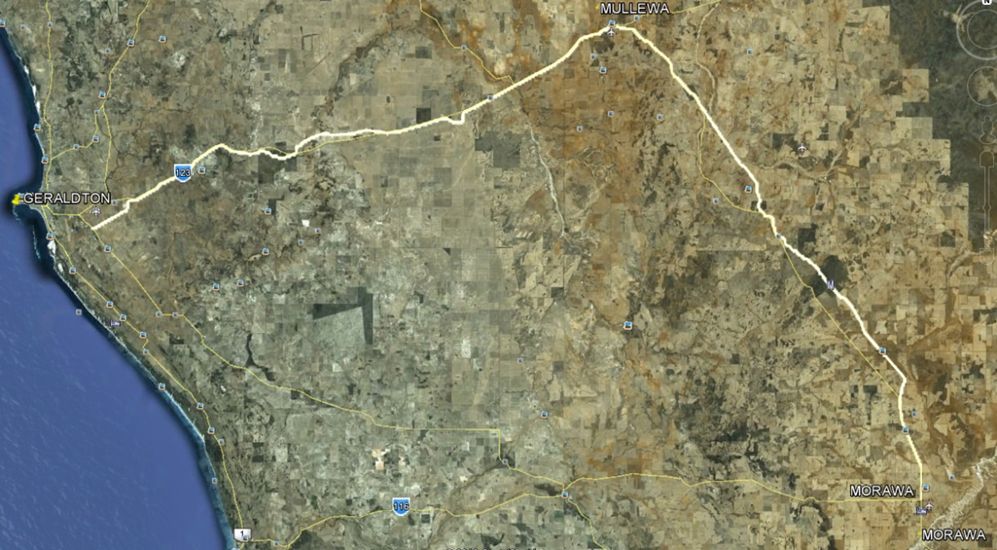
Brookfield Rail Line Survey Brookfield Rail Line Survey Overview AAM were commissioned to survey 188 kms of optimised rail line from Tilley Siding, Morawa to Narngulu Yard in Western Australia. The as-constructed survey required capturing the main line and passing track’s alignment amongst other services. An accuracy of +/- 0.03 or better was also required […]