


The role of the modern-day mining surveyor takes on a different form to its predecessor. While the basic principles of surveying remain unchanged, new technologies, software and processes have forever changed geomatics and how we can support the complete mining lifecycle.
With the Australian Institute of Mine Surveyors (AIMS) 2023 regional events kicking off in Kalgoorlie this month, let Woolpert Asia-Pacific share a glimpse into Australia’s representing body for mine surveyors, in line with the industry, dynamic technologies that have changed the way we work, and how the role has enabled end to end operations throughout a mine site.
What is AIMS?
Since its inception in 1980, AIMS has led the charge supporting qualified mine surveyors through professional representation to government, industry, and educational institutions. First established as a self-interest group of mine surveyors, AIMS began its emergence as the leading representative body for the profession and continues to be a powerful voice for its members.
For over 40 years, their presence has been widespread, felt through advocating for change, fostering professional development through hosted events, and mentoring the future generation. A central hub for knowledge sharing of new technologies, legislation, and employment opportunities, AIMS connects a community of registered and authorised mine surveyors, survey assistants, students and retired surveyors.
What is a mining surveyor?
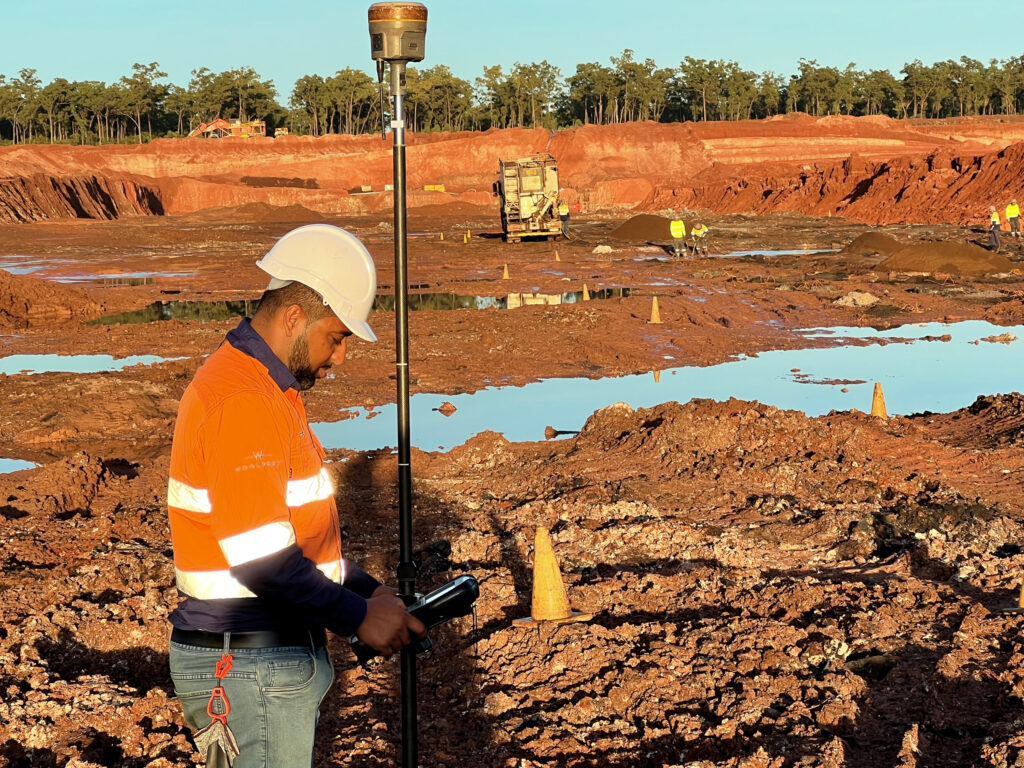
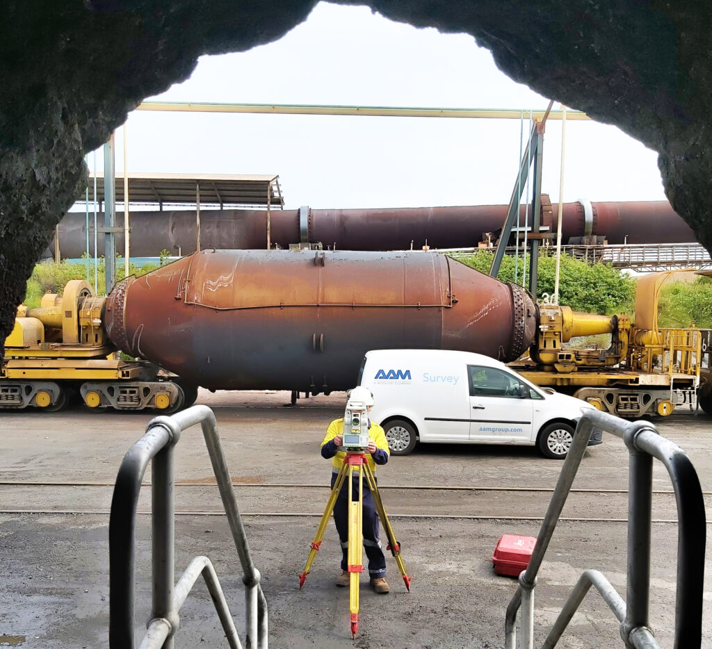
From interpreting conceptual ideas, and translating these to an executional requirement, the mining surveyor is a role of significant importance. From capturing data, creating datasets and producing reports, the work they do enables other mining disciplines to move forward in their own work. They are responsible for the accurate representation of mines through measuring underground and surface operations, as well as the areas and volumes mined. These insights underpin the planning, design, and safety of all mine workings.
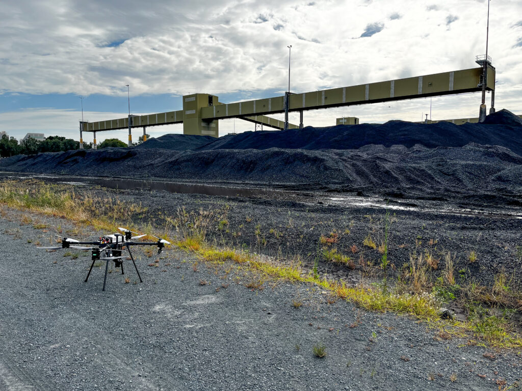
A once very physical role, the modern-day mining surveyor now adopts a more hybrid working model, they can be anywhere, everywhere, all at once – well kind of. With the latest remote scanning technologies available to market, barriers to survey are dramatically reduced with inaccessible and unfavourable terrain now within reach. No longer do surveyors always need to be on the ground, in and amongst the large machinery – and exposed to safety risks.
Moreover, new technology has brought rise to advanced software solutions changing how data is processed and delivered to the client, with the mining surveyor critical to its delivery.
Woolpert's history in mining
For more than 60 years, Woolpert has helped shape the Australian mining and resources sector with strong geospatial expertise and reliable results enabling operators’ bottom lines.
Woolpert’s work in mining first emerged in the 1960’s, born out of Conzinc RioTinto of Australia Limited (CRA), today, Rio Tinto, who had big leases for iron ore in the Tom Price Mine, and big coal leases in the Hunter Valley and Bowen Basin. A major player in the Hamersley Iron Railway from Tom Price Mine to the Port of Dampier, and later its Paraburdoo extension, Woolpert was cemented as trusted mapping and survey specialists. Following these successful pioneer projects, the pipeline of work continued to grow with Woolpert engaged to conduct the mapping and surveying of most of the heavy haul railway routes of the north of Australia.
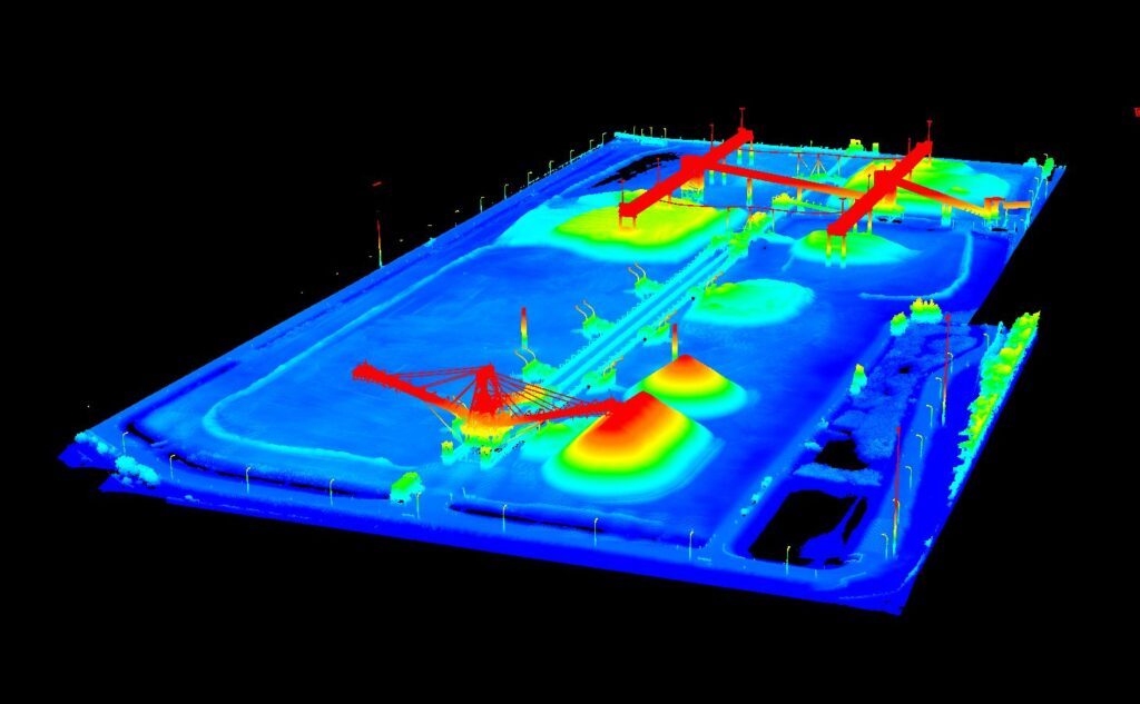
Today, Woolpert’s geospatial data and insights support the complete mining lifecycle from exploration to rehabilitation. Our mining and resources specific solutions are a major part of our core business and day-to-day operations.
Mapping and airborne solutions, whether that’s LiDAR, imagery or satellite products, are most in demand with our mining clients. We are also sought after for our survey services from ground control, infrastructure monitoring, lease preparation, and defining lease boundaries,” said Glenn Morrison, Director of Operations.
“Even Woolpert’s geospatial technology solutions are embedded within many of the mines we do work with, with software like VertiGIS Studio, the preferred GIS product for many of our clients.”
“With the emergence of Woolpert’s very own LiDARnetics platform born out of our work in mining, we can map better client outcomes through rapidly processing data for quick delivery.”
LiDARnetics provides Woolpert and its clients with the ability to meet rapid turnaround delivery timelines, critical in the mining lifecycle.
Some of Woolpert’s core customers are global top tier miners including Fortescue, BHP, Rio Tinto, Anglo American and Glencore and their associated entities.
Woolpert and AIMS
A longtime corporate supporter of AIMS, Woolpert is proud to be a part of a vibrant community of mining surveyors, fostering professional development and unified representation for issues that face the mining surveyor and industry as a whole. We lean on each other to maximise influence and draw upon our networks and members to move forward in the great work we do.
AIMS and Woolpert are intertwined. The industry knows we service that part of the world with our exposure through AIMS. While actively participating in AIMS regional and national events and programs means Woolpert can share our knowledge and expertise with the mining community,” said Anthony Boyd, Resources Account Manager.
“We also happily provide advice and guidance to AIMS members, whether we are working actively on their site, or we’ve worked with them previously.”
Woolpert are delighted to sponsor upcoming AIMS events including the Kalgoorlie Seminar on 15 February and Mudgee Regional Seminar on 10 March. Make sure you catch up with our Resources specialists Glenn Morrison and Anthony Boyd at our displays to learn more about Woolpert’s solutions for your mining needs.
 (1)")
")

")
")
")