


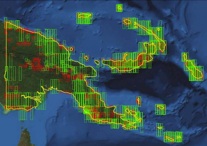
This week’s PNG archive analysis overviews the extensive and valuable library of existing 50cm DigitalGlobe satellite data. This can be quickly supplied and then mosaicked, enhanced and compressed to create products suitable for your project.
This vast quantity of multispectral imagery from DigitalGlobe has the capacity to highlight subtle differences in vegetation or coastal communities and ecosystems not readily attainable with natural colour imagery. Given the unique spectral qualities of DigitalGlobe’s WorldView-2 satellite, new levels of analysis can be undertaken.
This information about 50cm archive imagery complements our earlier story from February 25 about the 5m image coverage for PNG available from RapidEye. View that story by clicking here.
DigitalGlobe’s vast image library is available from AAM. Contact us to discuss your terrain and imagery requirements.
PNG: 50cm Satellite Imagery in Archive
Captured from 2010-2013 with less than 20% Cloud Cover
Overview of 0.5m imagery: GeoEye-1 (red polygons) and WorldView-2 (green polygons)
 (1)")
")

")
")
")