


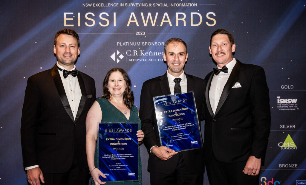
Another win for Woolpert for our bathymetric survey work in Australia’s Northern Rivers region! Congratulations to our Asia-Pacific team who took home the Excellence in Surveying and Spatial Information (EISSI) Award in the category of Extra Dimension and Innovation last Saturday evening.
This award category recognises how innovative techniques in surveying, spatial information, mapping, cartography, design, planning, and software development achieve exceptional outcomes and/or solve unusual problems. This was certainly the case as conducted bathymetric survey of the Richmond and Tweed River catchments, a nominal 800 linear kilometres of riverways in the Northern Rivers region of New South Wales, to enable development of a hydrodynamic model to inform scenario analysis for long-term planning.
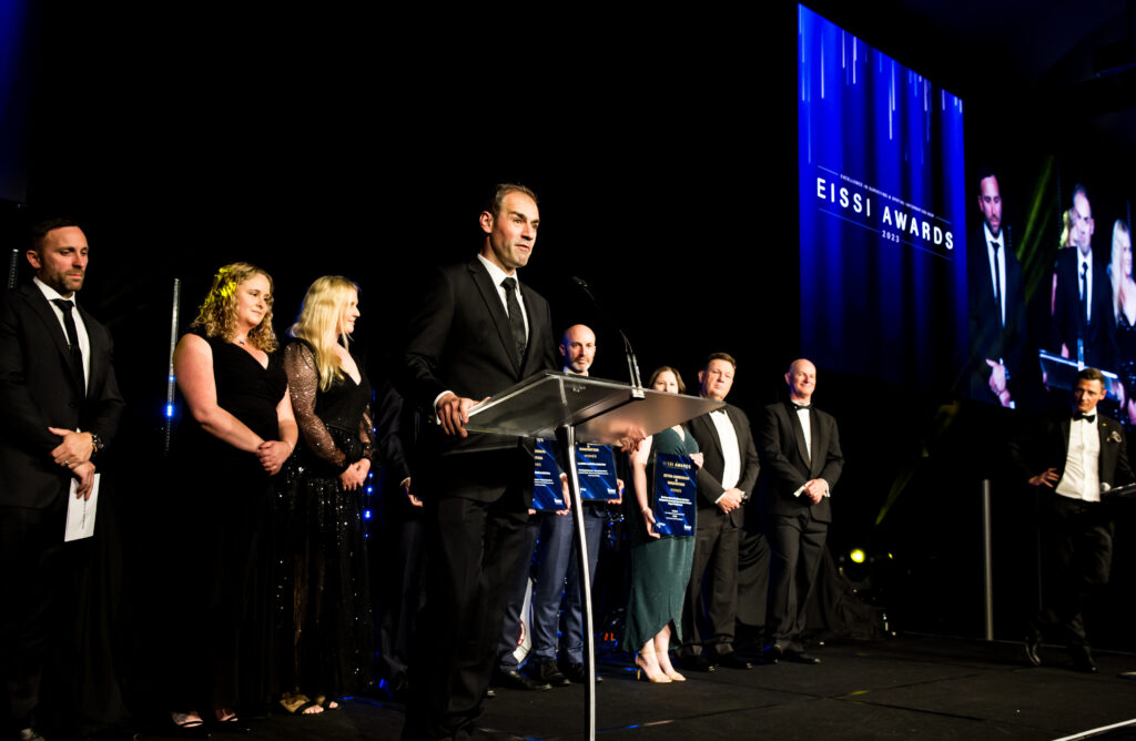
The EISSI Awards are jointly presented by the Association of Consulting Surveyors NSW and the Institution of Surveyors NSW (ISNSW), to recognise and acknowledge excellence in the surveying and spatial information industry.
The Extra Dimension and Innovation Award is sponsored by the ISNSW Cumberland Group and recognises how innovative techniques in surveying, spatial information mapping, cartography, design, planning and software development achieve exceptional outcomes and/or solve unusual problems.
The Northern Rivers Resilience Initiative
The 2022 East Coast floods is Australia’s most expensive natural disaster recorded in history. Costing more than $5.65billion and leaving numerous communities displaced, the impact is still felt to this day. A $11.4million flood mitigation survey, headed by Australia’s national science agency CSIRO, is an integral part of a bigger program funded by the Australian Government – The Northern Rivers Resilience Initiative. As part of this initiative, Woolpert conducted bathymetric survey works of the Richmond and Tweed River catchments.
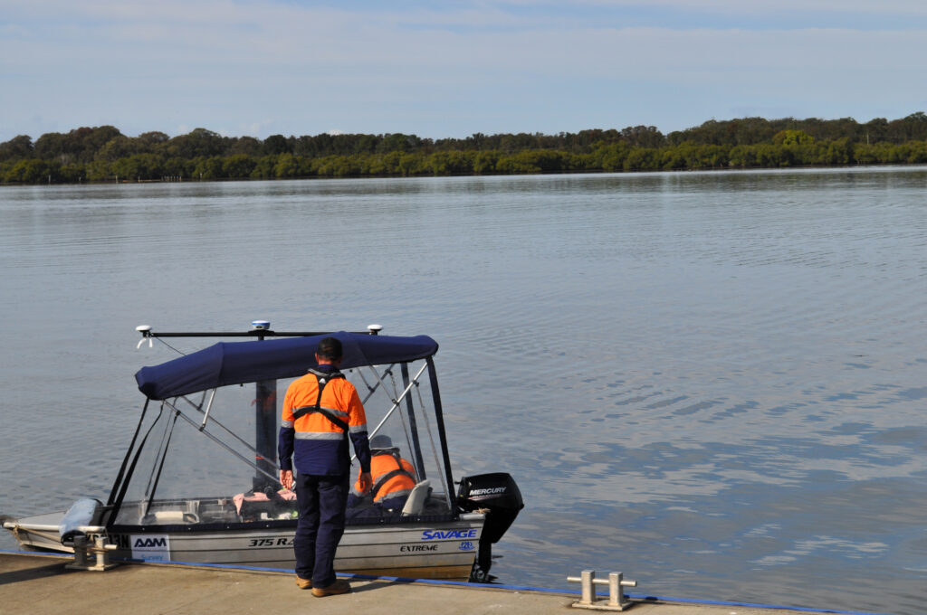
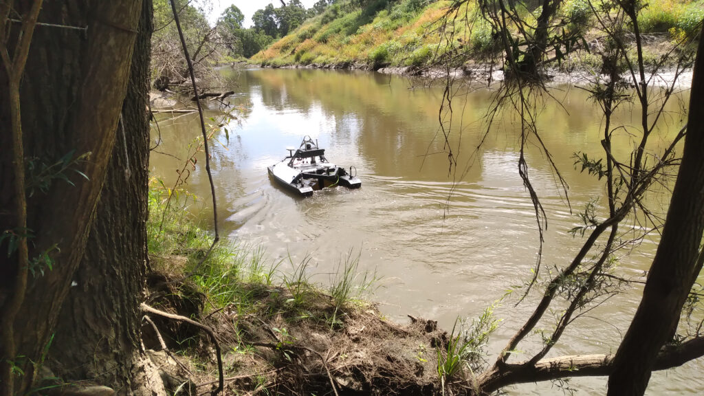
Pairing science with community insight to inform investment, the Woolpert survey team were key to delivering actionable insights that would ultimately aid to mitigate future disaster events and rebuild affected local government areas. Using interferometric side scanning sonar equipment, Woolpert implemented both manned and unmanned vessels to harvest data from an extensive network of rivers, streams and dams, throughout the period of July 2022 to June 2023.
Drawing on Woolpert’s expertise in and around bodies of water, the team delivered a topographic map of the riverbed, and hydrological and hydrodynamic water movement modelling. Woolpert’s bathymetry survey data was supplemented by airborne LiDAR data that was used to produce digital elevation models, valuable in collecting data in areas difficult to access via vessels. The 3D bathymetric datasets will enable development of a detailed hydrodynamic model of the Richmond River catchment to inform scenario analysis for long-term planning.
This geospatial data is critical for the design and placement of future infrastructure, community assets, residential developments and commercial premises.
Congratulations to all the winners and finalists, and thank you to the Woolpert team committed to delivering these outputs, including Technical Lead Ross Macdonald, Project Manager Andrew Port, Project Support Officer Alexis Walburn, and the survey team of Roland Saftenberger, Brett Marr, Josh Eagan, Ben Smith, Sarah Iacono, and Ryan Lee. Also, congratulations and thank you to Dr Jai Vaze, Dr Cherry Mateo and the teams at CSIRO and National Emergency Management Agency for selecting us to partner with them on the Northern Rivers Resilience Initiative.

 (1)")
")

")
")
")